|
search place name
|
||
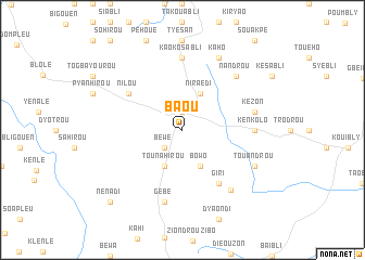
Baou (Cote d'Ivoire)Baou is a town in Cote d'Ivoire. An overview map of the region around Baou is displayed below.
regional and 3d topo map of Baou, Cote d'Ivoire ::
Baou airports ::
The nearest airport is MJC - Man, located 22.5 km west of Baou.
Other airports nearby include DJO - Daloa (113.4 km south east), Nearby towns ::
Totrou (1.9km north) //
Béwé (2.6km south west) //
Niraédi (4.1km north east) //
Bowo (4.1km south east) //
Tounahirou (4.1km south west) //
Nilou (6.6km north west) //
Giri (6.7km south east) //
Kaokosabli (7.4km north) //
Kenkolo (7.4km east) //
Kézon (7.6km east) //
Gébé (7.6km south) //
Nandrou (7.8km north east) //
Kyésérébli (7.8km north east) //
Diourouzon (7.9km south east) //
Kaho (8.3km north east) //
Touandrou (8.2km south east) //
Nénadi (10.4km south west) //
[all distances 'as the bird flies' and approximate] 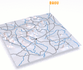 Places with similar names to Baou, Cote d'Ivoire ::
Disclaimer :: Information on this page comes without warranty of any kind |
||
|
Where is Baou? Elevation and coordinates ::
Latitude (lat): 7°16'0"N Longitude (lon): 7°23'0"W
Elevation (approx.): 419m (map arrows pan, magnifying glasses zoom) |
||
|
Visiting Baou? Hotel/Accommodation ::
Book a hotel in Baou Travel Guide ::
rental cars ::
car rental offers GPS waypoint ::
download a GPX waypoint (PoI) of Baou for your GPS receiver
|
||