|
search place name
|
||
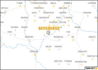
Bengbwaso (Cote d'Ivoire)Bengbwaso is a town in Cote d'Ivoire. An overview map of the region around Bengbwaso is displayed below.
regional and 3d topo map of Bengbwaso, Cote d'Ivoire ::
Bengbwaso airports ::
The nearest airport is MJC - Man, located 88.7 km south of Bengbwaso.
Other airports nearby include DJO - Daloa (200.6 km south east), Nearby towns ::
Koviano (1.9km north) //
Sougwékan (1.8km west) //
Singo (3.7km north) //
Tifengan (4.1km north east) //
Yafaso (4.1km north east) //
Mamouéso (4.1km south east) //
Walou (5.6km south) //
Séso (5.9km north) //
Touméniso (5.9km north) //
Téko (6.7km north east) //
Watiso (6.6km north east) //
Koungo (6.7km south east) //
Tiko (7.3km east) //
Kosafinizo (7.4km north) //
Gouékan (7.6km west) //
Gendéma (7.8km north west) //
Sokourala (8.2km north east) //
Tyémaso (9.2km north east) //
Sifié (9.2km north west) //
Namaso (9.2km north east) //
Ouoféso (9.2km south west) //
[all distances 'as the bird flies' and approximate] 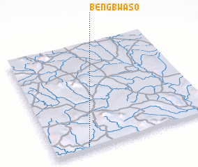 Places with similar names to Bengbwaso, Cote d'Ivoire :: Disclaimer :: Information on this page comes without warranty of any kind |
||
|
Where is Bengbwaso? Elevation and coordinates ::
Latitude (lat): 8°3'0"N Longitude (lon): 7°47'0"W
Elevation (approx.): 470m (map arrows pan, magnifying glasses zoom) |
||
|
Visiting Bengbwaso? Hotel/Accommodation ::
Book a hotel in Bengbwaso Travel Guide ::
rental cars ::
car rental offers GPS waypoint ::
download a GPX waypoint (PoI) of Bengbwaso for your GPS receiver
|
||