|
search place name
|
||
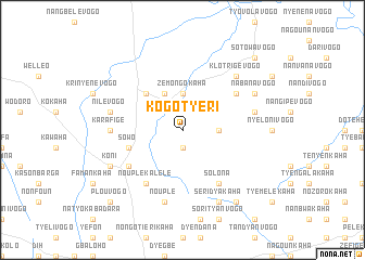
Kogotyèri (Cote d'Ivoire)Kogotyèri is a town in Cote d'Ivoire. An overview map of the region around Kogotyèri is displayed below.
regional and 3d topo map of Kogotyèri, Cote d'Ivoire ::
Kogotyèri airports ::
The nearest airport is HGO - Korhogo, located 26.2 km south of Kogotyèri.
Other airports nearby include BYK - Bouake (216.1 km south), BOY - Bobo-dioulasso Bobo Dioulasso (221.3 km north east), Nearby towns ::
Tiorotiérivogo (1.9km south) //
Zémongokaha (3.7km north) //
Tyohobélé-Kohotyéri (3.7km east) //
Syelèkaha (4.1km north west) //
Tawara (5.2km north west) //
Sowo (5.8km west) //
Nouplé Kalélé (6.7km south west) //
Koulodyovogo (6.6km north east) //
Lataha (6.7km south east) //
Solona (6.7km south east) //
Gbodonon (6.6km south west) //
Karafigé (7.3km west) //
Nilévogo (7.5km west) //
Nouplé (7.6km south) //
Kouwovogo (7.5km east) //
Klotrigévogo (7.8km north east) //
Koni (8.2km south west) //
Dyavogo (8.2km north east) //
Nabanavogo (8.2km north east) //
Seridyakaha (8.3km south east) //
Lohonyonkaha (9.2km south east) //
Tabara (9.2km south east) //
Lofiné (10.4km south west) //
Plouvogo (10.4km south west) //
Sotowavogo (10.4km north east) //
[all distances 'as the bird flies' and approximate] 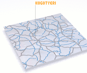 Places with similar names to Kogotyèri, Cote d'Ivoire ::
// Kaygatyur (RU)
Disclaimer :: Information on this page comes without warranty of any kind |
||
|
Where is Kogotyèri? Elevation and coordinates ::
Latitude (lat): 9°37'0"N Longitude (lon): 5°37'0"W
Elevation (approx.): 343m (map arrows pan, magnifying glasses zoom) |
||
|
Visiting Kogotyèri? Hotel/Accommodation ::
Book a hotel in Kogotyèri Travel Guide ::
rental cars ::
car rental offers GPS waypoint ::
download a GPX waypoint (PoI) of Kogotyèri for your GPS receiver
|
||