|
search place name
|
||
Kondorobo (Cote d'Ivoire)Kondorobo is a town in Cote d'Ivoire. An overview map of the region around Kondorobo is displayed below.
regional and 3d topo map of Kondorobo, Cote d'Ivoire ::

Kondorobo airports ::
The nearest airport is ASK - Yamoussoukro, located 46.6 km south of Kondorobo.
Other airports nearby include BYK - Bouake (61.3 km north east), DJO - Daloa (128.5 km south west), Nearby towns ::
Sorofoué (4.2km north) //
Yakakoukro (4.8km north east) //
Kofi Agokro (5.9km south west) //
Doupa (7.1km south east) //
Koumélé (7.2km east) //
Abikofikro (7.4km west) //
Kofessou (7.9km north west) //
Zuenda (8.0km north west) //
Simbo (8.2km south east) //
Ano Doupa (8.2km south east) //
Zumé (8.7km south east) //
Kouassikrokro (8.9km north east) //
Ya-Sakasso-Kansi (9.6km south west) //
Nianda (9.7km north east) //
[all distances 'as the bird flies' and approximate] 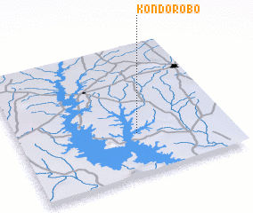 Places with similar names to Kondorobo, Cote d'Ivoire ::
// Condaraba (ET)
// Kindarib (PG)
// Gander Bay (CA)
// Cañada Arriba (DO)
// Canete Arriba (DO)
// Cuenda Arriba (DO)
// Kondorobo (CI)
// Kondorobo (CI)
// Kondorobo (CI)
Disclaimer :: Information on this page comes without warranty of any kind |
||
|
Where is Kondorobo? Elevation and coordinates ::
Latitude (lat): 7°19'8"N Longitude (lon): 5°26'10"W
Elevation (approx.): 213m (map arrows pan, magnifying glasses zoom) |
||
|
Visiting Kondorobo? Hotel/Accommodation ::
Book a hotel in Kondorobo Travel Guide ::
rental cars ::
car rental offers GPS waypoint ::
download a GPX waypoint (PoI) of Kondorobo for your GPS receiver
|
||