|
search place name
|
||
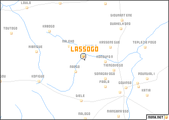
Lassogo (Cote d'Ivoire)Lassogo is a town in Cote d'Ivoire. An overview map of the region around Lassogo is displayed below.
regional and 3d topo map of Lassogo, Cote d'Ivoire ::
Lassogo airports ::
The nearest airport is HGO - Korhogo, located 99.1 km south of Lassogo.
Other airports nearby include BOY - Bobo-dioulasso Bobo Dioulasso (179.9 km north east), Nearby towns ::
Louholo (2.4km north east) //
Nargo (3.3km south west) //
Nalého (4.6km north west) //
Koroufon (4.6km east) //
Ladié (6.2km south east) //
Sonagavogo (6.2km south east) //
Kassérégué (6.3km north east) //
Tiengovogo (6.8km east) //
Faala (7.5km south east) //
Kabogo (10.0km north west) //
Ouamélhoro (10.6km north east) //
Niellé (10.6km south east) //
Dioumanténé (12.1km north east) //
[all distances 'as the bird flies' and approximate] 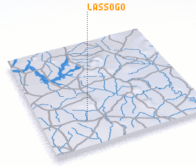 Places with similar names to Lassogo, Cote d'Ivoire ::
Disclaimer :: Information on this page comes without warranty of any kind |
||
|
Where is Lassogo? Elevation and coordinates ::
Latitude (lat): 10°16'14"N Longitude (lon): 5°42'30"W
Elevation (approx.): 326m (map arrows pan, magnifying glasses zoom) |
||
|
Visiting Lassogo? Hotel/Accommodation ::
Book a hotel in Lassogo Travel Guide ::
rental cars ::
car rental offers GPS waypoint ::
download a GPX waypoint (PoI) of Lassogo for your GPS receiver
|
||