|
search place name
|
||
Niangokadé (Cote d'Ivoire)Niangokadé is a town in Cote d'Ivoire. An overview map of the region around Niangokadé is displayed below.
regional and 3d topo map of Niangokadé, Cote d'Ivoire ::

Niangokadé airports ::
The nearest airport is DJO - Daloa, located 130.2 km north west of Niangokadé.
Other airports nearby include SPY - San Pedro (134.9 km south west), ASK - Yamoussoukro (144.3 km north east), MJC - Man (248.0 km north west), Nearby towns ::
Niakoblonyoa (3.2km south west) //
Sokotohué (3.8km east) //
Bobolilié (3.9km east) //
Niaouriyo (6.3km north) //
Kiripoko Un (7.4km south east) //
Pahironyoa (8.6km south west) //
Bodonyoa (8.8km north west) //
Lekidou Pépézo (10.4km south east) //
Niahouahué (10.5km south east) //
[all distances 'as the bird flies' and approximate] 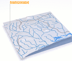 Places with similar names to Niangokadé, Cote d'Ivoire ::
// Naungkut (MM)
// Naungkut (MM)
// Nawngkut (MM)
// Nanga Gaat (MY)
// Nanoko Kuta (ZM)
// Nung Ukot (NG)
// Nangkita (AU)
Disclaimer :: Information on this page comes without warranty of any kind |
||
|
Where is Niangokadé? Elevation and coordinates ::
Latitude (lat): 5°44'16"N Longitude (lon): 5°57'7"W
Elevation (approx.): 192m (map arrows pan, magnifying glasses zoom) |
||
|
Visiting Niangokadé? Hotel/Accommodation ::
Book a hotel in Niangokadé Travel Guide ::
rental cars ::
car rental offers GPS waypoint ::
download a GPX waypoint (PoI) of Niangokadé for your GPS receiver
|
||