|
search place name
|
||
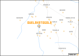
Ouélakatogola (Cote d'Ivoire)Ouélakatogola is a town in Cote d'Ivoire. An overview map of the region around Ouélakatogola is displayed below.
regional and 3d topo map of Ouélakatogola, Cote d'Ivoire ::
Ouélakatogola airports ::
The nearest airport is MJC - Man, located 118.0 km south west of Ouélakatogola.
Other airports nearby include DJO - Daloa (121.4 km south), BYK - Bouake (179.9 km east), ASK - Yamoussoukro (181.8 km south east), HGO - Korhogo (210.0 km north east), Nearby towns ::
Barandjé (1.9km south) //
Bofraka (1.9km south) //
Soba (3.1km south east) //
Mouina (3.5km south) //
Sotiéma (3.7km south) //
Ouarhama (3.7km south) //
Boovo (5.1km north east) //
Sakouaso (5.2km south east) //
Dyarabala (5.8km east) //
Lengékro (5.8km east) //
Kouroumana (5.9km north) //
Gbalo (5.9km north east) //
Gbéna (6.2km north west) //
Kavéna (6.2km north east) //
Somina (6.7km north west) //
Ouahi (7.0km south east) //
Diamina (7.1km east) //
Suala (7.6km east) //
Téguéla (8.1km east) //
[all distances 'as the bird flies' and approximate] 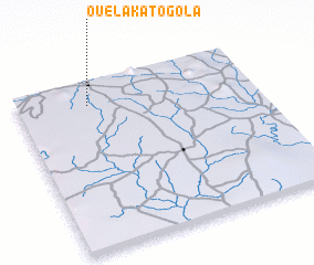 Places with similar names to Ouélakatogola, Cote d'Ivoire :: Disclaimer :: Information on this page comes without warranty of any kind |
||
|
Where is Ouélakatogola? Elevation and coordinates ::
Latitude (lat): 7°52'0"N Longitude (lon): 6°42'0"W
Elevation (approx.): 342m (map arrows pan, magnifying glasses zoom) |
||
|
Visiting Ouélakatogola? Hotel/Accommodation ::
Book a hotel in Ouélakatogola Travel Guide ::
rental cars ::
car rental offers GPS waypoint ::
download a GPX waypoint (PoI) of Ouélakatogola for your GPS receiver
|
||