|
search place name
|
||
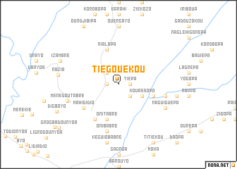
Tiégouékou (Cote d'Ivoire)Tiégouékou is a town in Cote d'Ivoire. An overview map of the region around Tiégouékou is displayed below.
regional and 3d topo map of Tiégouékou, Cote d'Ivoire ::
Tiégouékou airports ::
The nearest airport is DJO - Daloa, located 86.0 km north west of Tiégouékou.
Other airports nearby include ASK - Yamoussoukro (97.1 km north east), SPY - San Pedro (183.1 km south west), BYK - Bouake (191.7 km north east), MJC - Man (215.9 km north west), Nearby towns ::
Tiépa (1.8km east) //
Gbaléhigbrapa (1.8km west) //
Dayépa (1.8km west) //
Bayékou-Bassi (2.6km south east) //
Boussehio (2.6km north west) //
Dahiropa (2.6km north west) //
Kouassopo (4.1km south east) //
Dobrépa (5.8km east) //
Oni-Tabré (5.9km south) //
Nialapa (5.9km north) //
Dobiésséroya (6.7km south west) //
Mahididio (6.7km south west) //
Mahidio (6.7km south west) //
Kousségouépa (7.6km east) //
Oni-Babré (7.6km south) //
Niayo-Dégoué (7.6km south) //
Naguiguépa (8.2km south east) //
Diahouripa (8.2km south east) //
Ménédou-Tabré (8.5km west) //
[all distances 'as the bird flies' and approximate] 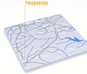 Places with similar names to Tiégouékou, Cote d'Ivoire ::
Disclaimer :: Information on this page comes without warranty of any kind |
||
|
Where is Tiégouékou? Elevation and coordinates ::
Latitude (lat): 6°14'0"N Longitude (lon): 5°56'0"W
Elevation (approx.): 243m (map arrows pan, magnifying glasses zoom) |
||
|
Visiting Tiégouékou? Hotel/Accommodation ::
Book a hotel in Tiégouékou Travel Guide ::
rental cars ::
car rental offers GPS waypoint ::
download a GPX waypoint (PoI) of Tiégouékou for your GPS receiver
|
||