|
search place name
|
||
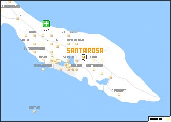
Santa Rosa (Netherlands Antilles)Santa Rosa is a town in Netherlands Antilles. An overview map of the region around Santa Rosa is displayed below.
regional and 3d topo map of Santa Rosa, Netherlands Antilles ::
Santa Rosa airports ::
The nearest airport is CUR - Willemstad Hato, located 11.5 km north west of Santa Rosa.
Other airports nearby include BON - Kralendijk Flamingo (66.9 km east), CZE - Coro Jose Leonardo Chirinos (116.6 km south west), AUA - Oranjestad Reina Beatrix Intl (130.3 km west), LSP - Paraguana Josefa Camejo (143.0 km west), Nearby towns ::
Libie (1.8km east) //
Kolontjie (1.8km west) //
Zeelandia (1.8km west) //
Rust en Vrede (1.8km west) //
Montan'i Rei (2.6km south east) //
Saliña (2.6km south west) //
Saliña Abou (2.6km south west) //
Dominguito (2.6km south west) //
Janwé (2.6km south west) //
Mari Pompun (3.3km south west) //
Paradijs (3.4km west) //
Steenrijk (3.5km south west) //
Bona Vista (3.6km east) //
Seritu (3.6km west) //
Cher Asile (3.6km west) //
Berg Altena (3.8km west) //
Nieuw Nederland (3.9km west) //
Ararat (4.0km west) //
Brievengat (4.1km north west) //
Emmastad (4.1km north west) //
Groot Kwartier (4.1km north west) //
Parera (4.1km south west) //
Fleur de Marie (4.1km south west) //
Pietermaai (4.1km south west) //
Punda (4.1km south west) //
Scharloo (4.1km south west) //
Vianen (4.1km south west) //
Willemstad (4.1km south west) //
Cornet (4.2km west) //
[all distances 'as the bird flies' and approximate] 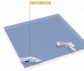 Places with similar names to Santa Rosa, Netherlands Antilles ::
// Sania Torres (MA)
// Santa Rosa (BR)
// Santa Rosa (BR)
// Santa Rosa (BR)
// Santa Rosa (BR)
// Santa Rosa (BR)
// Santa Rosa (BR)
// Santa Rosa (BR)
// Santa Rosa (BR)
// Santa Rosa (BR)
Disclaimer :: Information on this page comes without warranty of any kind |
||
|
Where is Santa Rosa? Elevation and coordinates ::
Latitude (lat): 12°7'0"N Longitude (lon): 68°53'0"W
Elevation (approx.): 34m (map arrows pan, magnifying glasses zoom) |
||
|
Visiting Santa Rosa? Hotel/Accommodation ::
Book a hotel in Santa Rosa Travel Guide ::
rental cars ::
car rental offers GPS waypoint ::
download a GPX waypoint (PoI) of Santa Rosa for your GPS receiver
|
||