|
search place name
|
||
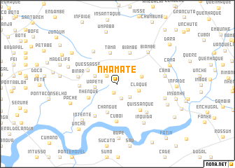
Nhamate (Oio, Guinea-Bissau)Nhamate is a town in the Oio region of Guinea-Bissau. An overview map of the region around Nhamate is displayed below.
regional and 3d topo map of Nhamate, Guinea-Bissau ::
Nhamate airports ::
The nearest airport is BXO - Bissau Oswaldo Vieira Intl, located 23.4 km south west of Nhamate.
Other airports nearby include ZIG - Ziguinchor (93.3 km north west), CSK - Cap Skiring (133.1 km west), BJL - Banjul Intl (181.6 km north west), TUD - Tambacounda (276.4 km north east), Nearby towns ::
Encherte (1.5km south west) //
Madina (2.1km north west) //
Manga (2.4km south) //
Flaque Intudé (2.7km north west) //
Quitamo (2.8km south east) //
Claque (3.5km east) //
Uápete (3.5km west) //
Paile (3.8km west) //
Embande (4.0km east) //
Changue (4.8km south) //
Nhenque (5.0km south west) //
Tama (5.1km north) //
Quessasse (5.1km north west) //
Biambe (5.3km north) //
Quissanque (5.4km south east) //
Cuboi (5.9km south) //
Nhenque (6.0km west) //
Bera (6.2km south west) //
Binar (6.3km west) //
Sádejar de Binar (6.4km north west) //
Chalè (6.4km south east) //
Biambe (7.0km north east) //
Inquida (7.5km south east) //
Camã (7.4km east) //
Clonque (7.7km east) //
Intente (7.9km south west) //
Pache (8.0km south west) //
Fabur (8.2km west) //
Umpabá (8.5km north) //
[all distances 'as the bird flies' and approximate]  Places with similar names to Nhamate, Guinea-Bissau ::
Disclaimer :: Information on this page comes without warranty of any kind |
||
|
Where is Nhamate? Elevation and coordinates ::
Latitude (lat): 12°5'19"N Longitude (lon): 15°34'3"W
Elevation (approx.): 29m (map arrows pan, magnifying glasses zoom) |
||
|
Visiting Nhamate? Hotel/Accommodation ::
Book a hotel in Nhamate Travel Guide ::
rental cars ::
car rental offers GPS waypoint ::
download a GPX waypoint (PoI) of Nhamate for your GPS receiver
|
||