|
search place name
|
||
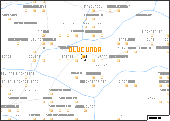
Olucunda (Guinea-Bissau)Olucunda is a town in Guinea-Bissau. An overview map of the region around Olucunda is displayed below.
regional and 3d topo map of Olucunda, Guinea-Bissau ::
Olucunda airports ::
The nearest airport is TUD - Tambacounda, located 132.4 km north of Olucunda.
Other airports nearby include BXO - Bissau Oswaldo Vieira Intl (188.6 km south west), KGG - Kedougou (202.5 km east), LEK - Labe (242.2 km south east), KLC - Kaolack (272.2 km north west), Nearby towns ::
Amedalai (1.8km east) //
Cantacunda (1.8km east) //
Sinchã Luntã (1.8km east) //
Bajocunda (1.9km north) //
Funtofuntula (1.8km west) //
Jaucunda (2.6km north west) //
Iufaná (3.6km east) //
Tabassi (3.6km west) //
Sinchã Dembel (3.6km west) //
Sare Sambi (4.1km south east) //
Sare Ióbà (4.1km south east) //
Tabajenque (4.1km north west) //
Quijem (4.1km south west) //
Guirocunda (5.2km south east) //
Bodeel (5.2km south east) //
Sare Mulai (5.4km west) //
Sinchã Jáliguè (5.4km west) //
Sinchã Sanfinta (5.8km south) //
Elacunda (5.7km east) //
Sare Sambi (5.8km north) //
Mansacunda Sinchã (5.7km east) //
Samadoro (5.7km east) //
Tenquinã (5.8km north) //
Maréuè (5.8km north) //
Madina Quêuto (6.6km north east) //
Colondinto (6.6km north west) //
Dimba Siriel (7.4km north) //
Mansacunda Maundè (7.2km east) //
Sinchã Nafà (7.2km east) //
[all distances 'as the bird flies' and approximate]  Places with similar names to Olucunda, Guinea-Bissau ::
Disclaimer :: Information on this page comes without warranty of any kind |
||
|
Where is Olucunda? Elevation and coordinates ::
Latitude (lat): 12°37'0"N Longitude (lon): 14°5'0"W
Elevation (approx.): 64m (map arrows pan, magnifying glasses zoom) |
||
|
Visiting Olucunda? Hotel/Accommodation ::
Book a hotel in Olucunda Travel Guide ::
rental cars ::
car rental offers GPS waypoint ::
download a GPX waypoint (PoI) of Olucunda for your GPS receiver
|
||