|
search place name
|
||
Samandim (Oio, Guinea-Bissau)Samandim is a town in the Oio region of Guinea-Bissau. An overview map of the region around Samandim is displayed below.
regional and 3d topo map of Samandim, Guinea-Bissau ::

Samandim airports ::
The nearest airport is BXO - Bissau Oswaldo Vieira Intl, located 100.4 km south west of Samandim.
Other airports nearby include ZIG - Ziguinchor (125.8 km west), CSK - Cap Skiring (177.8 km west), BJL - Banjul Intl (182.6 km north west), KLC - Kaolack (194.5 km north west), Nearby towns ::
Samã (1.1km south west) //
Sare Sajau (1.3km south east) //
Uassadu (2.7km south) //
Badem (2.8km south east) //
Sare Bori (2.8km east) //
Sare Nhado (3.0km east) //
Sare Samba Baldè (3.9km south east) //
Sare Baldè (3.9km south east) //
Sare Soriã (4.4km west) //
Sare Mancamã (4.5km south east) //
Sare Leão (5.4km south east) //
Sare Sofi (5.4km north west) //
Saré Diao (5.4km north west) //
Saré Yoro Diao (6.3km north) //
Cumbijã (6.3km east) //
Galo Gega (6.6km east) //
Saré Seni (6.8km north east) //
Norobanta Mandinga (6.7km east) //
Saré Bori (7.0km north west) //
Sare Lamine (7.2km south) //
Saré Goli (7.4km north) //
Fambantã (7.3km south west) //
Koumbidjan (7.8km north east) //
Jumbembem (7.9km south east) //
Jumbembem (8.2km south east) //
Saré Oumar (8.2km north east) //
Saré Souban (8.2km north east) //
Sinchã Tota (8.4km east) //
Norobanta Fula (8.4km east) //
[all distances 'as the bird flies' and approximate] 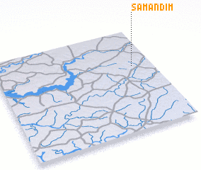 Places with similar names to Samandim, Guinea-Bissau ::
// Samba Ndama (GM)
// Seminiotembe (MZ)
Disclaimer :: Information on this page comes without warranty of any kind |
||
|
Where is Samandim? Elevation and coordinates ::
Latitude (lat): 12°38'24"N Longitude (lon): 15°7'37"W
Elevation (approx.): 38m (map arrows pan, magnifying glasses zoom) |
||
|
Visiting Samandim? Hotel/Accommodation ::
Book a hotel in Samandim Travel Guide ::
rental cars ::
car rental offers GPS waypoint ::
download a GPX waypoint (PoI) of Samandim for your GPS receiver
|
||