|
search place name
|
||
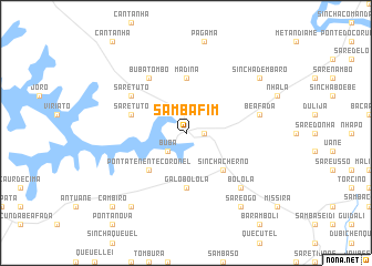
Sambafim (Guinea-Bissau)Sambafim is a town in Guinea-Bissau. An overview map of the region around Sambafim is displayed below.
regional and 3d topo map of Sambafim, Guinea-Bissau ::
Sambafim airports ::
The nearest airport is BXO - Bissau Oswaldo Vieira Intl, located 80.0 km north west of Sambafim.
Other airports nearby include ZIG - Ziguinchor (176.5 km north west), FIG - Fira Fria (207.3 km south east), CSK - Cap Skiring (211.9 km north west), BJL - Banjul Intl (264.3 km north west), Nearby towns ::
Sare Bamba (1.8km east) //
Buba (2.6km south west) //
Sinchã Cherno (5.2km south east) //
Ponta Tenente Coronel (5.2km south west) //
Galo Bolola (5.6km south) //
Madina (5.6km north) //
Sare Tuto (5.8km west) //
Sare Tuto (6.6km north west) //
Buba Tombó (6.6km north west) //
Beafada (7.5km east) //
Bolola (7.8km south east) //
Sinchã Dembaro (9.1km north east) //
Sare Ôgò (9.2km south east) //
Bambuti (9.2km south west) //
Cambirò (10.4km south west) //
[all distances 'as the bird flies' and approximate] 
Disclaimer :: Information on this page comes without warranty of any kind |
||
|
Where is Sambafim? Elevation and coordinates ::
Latitude (lat): 11°36'0"N Longitude (lon): 14°59'0"W
Elevation (approx.): 32m (map arrows pan, magnifying glasses zoom) |
||
|
Visiting Sambafim? Hotel/Accommodation ::
Book a hotel in Sambafim Travel Guide ::
rental cars ::
car rental offers GPS waypoint ::
download a GPX waypoint (PoI) of Sambafim for your GPS receiver
|
||