|
search place name
|
||
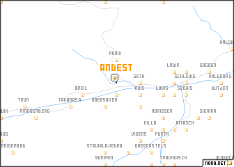
Andest (Aargau, Switzerland)Andest is a town in the Aargau region of Switzerland. An overview map of the region around Andest is displayed below.
regional and 3d topo map of Andest, Switzerland ::
Andest airports ::
The nearest airport is SMV - Samedan, located 64.9 km south east of Andest.
Other airports nearby include ACH - St Gallen Altenrhein (85.0 km north east), ZRH - Zurich (87.1 km north west), LUG - Lugano (88.0 km south), FDH - Friedrichshafen (103.2 km north), Nearby towns ::
Waltensburg (1.9km south) //
Rueun (2.5km east) //
Seth (2.5km east) //
Panix (3.7km north) //
Flond (3.1km south east) //
Ruis (3.1km south east) //
Meierhof (3.9km south) //
Obersaxen (3.9km south) //
Neukirch bei Ilanz (4.5km south east) //
Breíl (4.2km south west) //
Luvis (5.4km east) //
Danis (6.3km south west) //
Tavanasa (6.3km south west) //
Morissen (7.5km south east) //
Villa (8.3km south east) //
Cumbels (9.0km south east) //
[all distances 'as the bird flies' and approximate]  Places with similar names to Andest, Switzerland ::
// Andzad (MA)
// Andesite (US)
// Auna di Sotto (IT)
// Antuzede (PT)
// Andset (NO)
// Antsiety (MG)
// Antseta (MG)
// Antist (FR)
// Andezit (GE)
// Aïn Aït Zatou (MA)
Disclaimer :: Information on this page comes without warranty of any kind |
||
|
Where is Andest? Elevation and coordinates ::
Latitude (lat): 46°47'0"N Longitude (lon): 9°7'0"E
Elevation (approx.): 1057m (map arrows pan, magnifying glasses zoom) |
||
|
Visiting Andest? Hotel/Accommodation ::
Book a hotel in Andest Travel Guide ::
Buy a travel guide for Switzerland rental cars ::
car rental offers GPS waypoint ::
download a GPX waypoint (PoI) of Andest for your GPS receiver
|
||