|
search place name
|
||
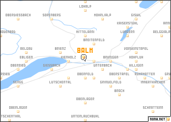
Balm (Aargau, Switzerland)Balm is a town in the Aargau region of Switzerland. An overview map of the region around Balm is displayed below.
regional and 3d topo map of Balm, Switzerland ::
Balm airports ::
The nearest airport is BRN - Bern Belp, located 48.3 km west of Balm.
Other airports nearby include SIR - Sion (82.8 km south west), ZRH - Zurich (87.0 km north east), MLH - Bale Mulhouse (102.3 km north west), LUG - Lugano (104.5 km south east), Nearby towns ::
Brienzwiler (1.3km east) //
Kienholz (2.5km west) //
Oberfeld (3.7km south) //
Breitenfeld (3.9km north) //
Bühlen (3.9km south) //
Unterbach (3.1km south east) //
Krautmettli (4.5km south west) //
Mittel Arni (5.6km north) //
Brünigen (3.8km east) //
Brienz (4.2km north west) //
Giessbach (5.4km west) //
Lütschental (6.7km south west) //
Gidisdorf (6.7km south west) //
Grindelfeld (6.7km south east) //
Ober Stafel (6.3km south east) //
Broch (9.0km south east) //
[all distances 'as the bird flies' and approximate] 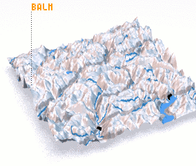 Places with similar names to Balm, Switzerland ::
Disclaimer :: Information on this page comes without warranty of any kind |
||
|
Where is Balm? Elevation and coordinates ::
Latitude (lat): 46°45'0"N Longitude (lon): 8°5'0"E
Elevation (approx.): 666m (map arrows pan, magnifying glasses zoom) |
||
|
Visiting Balm? Hotel/Accommodation ::
Book a hotel in Balm Travel Guide ::
Buy a travel guide for Switzerland rental cars ::
car rental offers GPS waypoint ::
download a GPX waypoint (PoI) of Balm for your GPS receiver
|
||