|
search place name
|
||
Disentis (Aargau, Switzerland)Disentis is a town in the Aargau region of Switzerland. An overview map of the region around Disentis is displayed below.
regional and 3d topo map of Disentis, Switzerland ::

Disentis airports ::
The nearest airport is LUG - Lugano, located 77.5 km south of Disentis.
Other airports nearby include SMV - Samedan (81.3 km east), ZRH - Zurich (88.0 km north), ACH - St Gallen Altenrhein (102.6 km north east), BRN - Bern Belp (106.0 km west), Nearby towns ::
Curaglia (2.2km south east) //
Mompetavetsch (2.2km south west) //
Medels (3.7km south) //
Disla (3.8km east) //
Platta (5.6km south) //
Pardè (5.6km south) //
Sedrun (5.4km west) //
Acla (7.5km south) //
Compadials (6.3km north east) //
[all distances 'as the bird flies' and approximate] 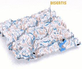 Places with similar names to Disentis, Switzerland ::
// Düßnitz (DE)
// Tuisendes (PT)
// Džindići (BA)
// Džindići (BA)
// Džindići (BA)
// Dzandza (CG)
// Dzandza (CG)
// Doussoundzi (GA)
// Dos Unidos (PE)
// Tsenets (TJ)
Disclaimer :: Information on this page comes without warranty of any kind |
||
|
Where is Disentis? Elevation and coordinates ::
Latitude (lat): 46°42'0"N Longitude (lon): 8°51'0"E
Elevation (approx.): 1165m (map arrows pan, magnifying glasses zoom) |
||
|
Visiting Disentis? Hotel/Accommodation ::
Book a hotel in Disentis Travel Guide ::
Buy a travel guide for Switzerland rental cars ::
car rental offers GPS waypoint ::
download a GPX waypoint (PoI) of Disentis for your GPS receiver
|
||