|
search place name
|
||
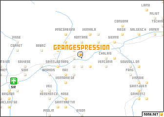
Granges-près-Sion (Aargau, Switzerland)Granges-près-Sion is a town in the Aargau region of Switzerland. An overview map of the region around Granges-près-Sion is displayed below.
regional and 3d topo map of Granges-près-Sion, Switzerland ::
Granges-près-Sion airports ::
The nearest airport is SIR - Sion, located 12.0 km south west of Granges-près-Sion.
Other airports nearby include BRN - Bern Belp (72.0 km north), QNJ - Annemasse (92.8 km west), GVA - Geneva Cointrin (104.7 km west), NCY - Annecy Meythet (112.2 km west), Nearby towns ::
Chermignon-dʼen Haut (1.9km north) //
Chermignon-dʼen Bas (1.3km west) //
Merdessonnet (1.9km south) //
Lens (2.3km north west) //
Itravers (2.3km south east) //
Grône (2.3km south west) //
Crans (3.7km north) //
Montana (3.7km north) //
Dailley (3.9km south) //
Montana-Village (4.5km north east) //
La Giète Délé (4.5km north west) //
Nax (4.5km south west) //
Chalais (3.8km east) //
Vermala (5.7km north) //
Saint-Romain (4.3km north west) //
Ayent (4.3km north west) //
Saint-Léonard (4.3km south west) //
Vercorin (4.3km south east) //
Randogne (6.1km north east) //
Pra Combèra (6.1km north west) //
Vernamiège (6.1km south west) //
Chippis (5.1km east) //
Sierre (6.3km north east) //
Bramois (6.3km south west) //
Vex (9.0km south west) //
[all distances 'as the bird flies' and approximate] 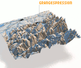 Places with similar names to Granges-près-Sion, Switzerland :: Disclaimer :: Information on this page comes without warranty of any kind |
||
|
Where is Granges-près-Sion? Elevation and coordinates ::
Latitude (lat): 46°16'0"N Longitude (lon): 7°28'0"E
Elevation (approx.): 509m (map arrows pan, magnifying glasses zoom) |
||
|
Visiting Granges-près-Sion? Hotel/Accommodation ::
Book a hotel in Granges-près-Sion Travel Guide ::
Buy a travel guide for Switzerland rental cars ::
car rental offers GPS waypoint ::
download a GPX waypoint (PoI) of Granges-près-Sion for your GPS receiver
|
||