|
search place name
|
||
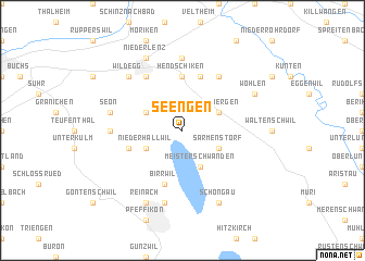
Seengen (Aargau, Switzerland)Seengen is a town in the Aargau region of Switzerland. An overview map of the region around Seengen is displayed below.
regional and 3d topo map of Seengen, Switzerland ::
Seengen airports ::
The nearest airport is ZRH - Zurich, located 29.0 km north east of Seengen.
Other airports nearby include MLH - Bale Mulhouse (59.1 km north west), BRN - Bern Belp (71.8 km south west), ZQL - Donaueschingen Villingen (74.8 km north), ACH - St Gallen Altenrhein (102.8 km east), Nearby towns ::
Sarmenstorf (3.1km south east) //
Fahrwangen (3.9km south) //
Meisterschwanden (3.9km south) //
Villmergen (3.1km north east) //
Boniswil (3.1km south west) //
Niederhallwil (3.1km south west) //
Egliswil (3.1km north west) //
Hendschiken (5.6km north) //
Dottikon (5.7km north) //
Leutwil (4.2km south west) //
Birrwil (5.7km south) //
Hägglingen (6.1km north east) //
Lenzburg (6.1km north west) //
Dürrenäsch (5.0km west) //
Othmarsingen (7.4km north) //
Beinwil (7.5km south) //
Seon (5.4km west) //
Wildegg (6.7km north west) //
Staufen (6.7km north west) //
Aesch (7.8km south) //
Nieder-Schongau (7.8km south) //
Ober-Schongau (7.8km south) //
Schongau (7.8km south) //
Reinach (7.8km south) //
Wohlen (6.2km north east) //
Niederlenz (7.8km north) //
[all distances 'as the bird flies' and approximate] 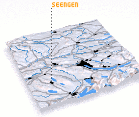 Places with similar names to Seengen, Switzerland ::
Disclaimer :: Information on this page comes without warranty of any kind |
||
|
Where is Seengen? Elevation and coordinates ::
Latitude (lat): 47°20'0"N Longitude (lon): 8°13'0"E
Elevation (approx.): 598m (map arrows pan, magnifying glasses zoom) |
||
|
Visiting Seengen? Hotel/Accommodation ::
Book a hotel in Seengen Travel Guide ::
Buy a travel guide for Switzerland rental cars ::
car rental offers GPS waypoint ::
download a GPX waypoint (PoI) of Seengen for your GPS receiver
|
||