|
search place name
|
||
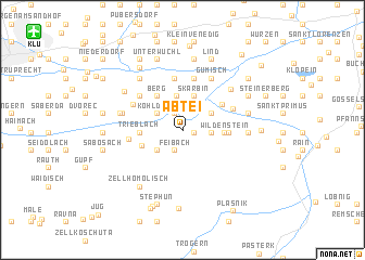
Abtei (Kärnten, Austria)Abtei is a town in the Kärnten region of Austria. An overview map of the region around Abtei is displayed below.
regional and 3d topo map of Abtei, Austria ::
Abtei airports ::
The nearest airport is KLU - Klagenfurt (Worthersee Intl), located 14.5 km north west of Abtei.
Other airports nearby include LJU - Ljubliana Ljubljana (36.5 km south), GRZ - Graz (88.5 km north east), MBX - Maribor (93.4 km east), TRS - Ronchi De Legionari Ronchi Dei Legionari (111.6 km south west), Nearby towns ::
Robesch (0.8km east) //
Saager (1.7km north) //
Feibach (2.1km south) //
Abriach (2.1km east) //
Kohldorf (2.4km north west) //
Oberdörfl (2.7km south west) //
Goritschach (2.6km north east) //
Sabuatach (3.5km north) //
Skarbin (3.6km north) //
Berg (3.9km north west) //
Wildenstein (3.0km east) //
Niederdörfl (3.3km south west) //
Trieblach (3.1km west) //
Gallizien (3.3km east) //
Nageltschach (3.8km north east) //
Grafenstein (5.4km north) //
Sankt Peter (5.4km north) //
Vellach (4.1km north east) //
Sankt Margareten im Rosental (3.8km west) //
Untermieger (4.6km north west) //
Obermieger (4.6km north west) //
Rute (4.4km north west) //
Kreuth (4.4km north west) //
Gumisch (5.7km north) //
Kozje (4.6km north west) //
Kossiach (4.6km north west) //
Unterkreuth (4.6km west) //
Rottenstein (4.6km west) //
Möchling (5.4km north east) //
[all distances 'as the bird flies' and approximate] 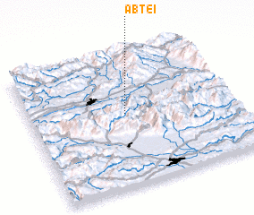 Places with similar names to Abtei, Austria ::
Disclaimer :: Information on this page comes without warranty of any kind |
||
|
Where is Abtei? Elevation and coordinates ::
Latitude (lat): 46°33'7"N Longitude (lon): 14°28'24"E
Elevation (approx.): 698m (map arrows pan, magnifying glasses zoom) |
||
|
Visiting Abtei? Hotel/Accommodation ::
Book a hotel in Abtei Travel Guide ::
Buy a travel guide for Austria rental cars ::
car rental offers GPS waypoint ::
download a GPX waypoint (PoI) of Abtei for your GPS receiver
|
||