|
search place name
|
||
Angath (Austria)Angath is a town in Austria. An overview map of the region around Angath is displayed below.
regional and 3d topo map of Angath, Austria ::

Angath airports ::
The nearest airport is INN - Innsbruck, located 60.7 km south west of Angath.
Other airports nearby include SZG - Salzburg (77.6 km north east), OBF - Oberpfaffenhofen (87.3 km north west), MUC - Munich Munchen (97.2 km north), FEL - Fuerstenfeldbruck Furstenfeldbruck (98.7 km north west), Nearby towns ::
Kastengstatt (0.0km north) //
Bruggermühl (1.3km east) //
Oberndorf (1.3km east) //
Söcking (1.3km west) //
Wörgl (1.9km south) //
Oberlangkampfen (2.2km north east) //
Kirchbichl (2.2km north east) //
Strass (2.2km north west) //
Baumgarten (2.2km north west) //
Achleit (2.5km west) //
Niederbreitenbach (3.9km north) //
Wörgler Boden (3.1km south east) //
Bichlwang (3.1km north east) //
Mariastein (3.9km north) //
Esbaum (3.9km south) //
Haus (5.6km south) //
Schönau (3.8km east) //
Häring (3.8km east) //
Höllham (3.8km west) //
Grafenweg (5.7km south) //
Niederau (5.7km south) //
Oberau (5.7km south) //
Brugghäusl (4.2km south east) //
Haus (4.2km south east) //
Glatzham (4.2km south west) //
Thal (4.2km south west) //
Embach (4.2km north west) //
Unterlangkampfen (6.1km north east) //
Söll-Leukental (5.3km east) //
[all distances 'as the bird flies' and approximate] 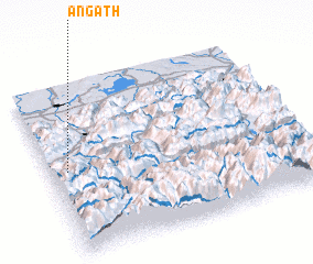 Places with similar names to Angath, Austria ::
Disclaimer :: Information on this page comes without warranty of any kind |
||
|
Where is Angath? Elevation and coordinates ::
Latitude (lat): 47°30'0"N Longitude (lon): 12°4'0"E
Elevation (approx.): 505m (map arrows pan, magnifying glasses zoom) |
||
|
Visiting Angath? Hotel/Accommodation ::
Book a hotel in Angath Travel Guide ::
Buy a travel guide for Austria rental cars ::
car rental offers GPS waypoint ::
download a GPX waypoint (PoI) of Angath for your GPS receiver
|
||