|
search place name
|
||
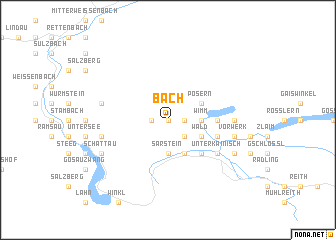
Bach (Steiermark, Austria)Bach is a town in the Steiermark region of Austria. An overview map of the region around Bach is displayed below.
regional and 3d topo map of Bach, Austria ::
Bach airports ::
The nearest airport is SZG - Salzburg, located 57.5 km west of Bach.
Other airports nearby include LNZ - Linz (Horsching) (74.8 km north east), KLU - Klagenfurt (Worthersee Intl) (119.3 km south east), GRZ - Graz (147.5 km south east), MUC - Munich Munchen (165.9 km north west), Nearby towns ::
Vorder-Lupitsch (0.0km north) //
Gründl (0.0km north) //
Lichtersberg (0.0km north) //
Unter-Lupitsch (0.0km north) //
Ober-Lupitsch (1.2km west) //
Mitteregg (1.2km west) //
Klaus (1.2km east) //
Reith (1.2km east) //
Vogelbichl (2.2km south east) //
Ischlberg (2.2km south east) //
Helmbichl (2.2km south east) //
Sarstein (3.7km south) //
Altaussee (2.5km east) //
Arzleiten (2.5km east) //
Fischerndorf (2.5km east) //
Hollau (2.5km east) //
Puchen (2.5km east) //
Wimm (2.5km east) //
Reitern (3.9km south) //
Wald (3.1km south east) //
Hinterposern (3.1km north east) //
Posern (3.1km north east) //
Lerchenreith (4.5km south east) //
Platten (3.7km east) //
Praunfalk (4.2km south east) //
Obertressen (4.2km south east) //
Unterkainisch (5.3km south east) //
Bad Aussee (5.3km south east) //
Eselsbach (5.3km south east) //
[all distances 'as the bird flies' and approximate]  Places with similar names to Bach, Austria ::
Disclaimer :: Information on this page comes without warranty of any kind |
||
|
Where is Bach? Elevation and coordinates ::
Latitude (lat): 47°38'0"N Longitude (lon): 13°44'0"E
Elevation (approx.): 958m (map arrows pan, magnifying glasses zoom) |
||
|
Visiting Bach? Hotel/Accommodation ::
Book a hotel in Bach Travel Guide ::
Buy a travel guide for Austria rental cars ::
car rental offers GPS waypoint ::
download a GPX waypoint (PoI) of Bach for your GPS receiver
|
||