|
search place name
|
||
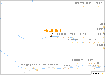
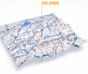
Feldner (Tirol, Austria)Feldner is a town in the Tirol region of Austria. An overview map of the region around Feldner is displayed below.
regional and 3d topo map of Feldner, Austria ::
Feldner airports ::
The nearest airport is INN - Innsbruck, located 81.0 km west of Feldner.
Other airports nearby include SZG - Salzburg (99.5 km north east), BZO - Bolzano (99.7 km south west), AVB - Aviano Ab (Pagliano E Gori) (111.1 km south), OBF - Oberpfaffenhofen (143.0 km north west), Nearby towns ::
 Places with similar names to Feldner, Austria ::
// Villa Tunari (BO)
// Villa Tunari (BO)
// Valtónera (GR)
// Vallo di Nera (IT)
// Vale de Neira (PT)
// Flatnor (SE)
Disclaimer :: Information on this page comes without warranty of any kind |
||
|
Where is Feldner? Elevation and coordinates ::
Latitude (lat): 47°1'0"N Longitude (lon): 12°21'0"E
Elevation (approx.): 1321m (map arrows pan, magnifying glasses zoom) |
||
|
Visiting Feldner? Hotel/Accommodation ::
Book a hotel in Feldner Travel Guide ::
Buy a travel guide for Austria rental cars ::
car rental offers GPS waypoint ::
download a GPX waypoint (PoI) of Feldner for your GPS receiver
|
||