|
search place name
|
||
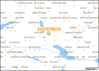
Guggenberg (Oberösterreich, Austria)Guggenberg is a town in the Oberösterreich region of Austria. An overview map of the region around Guggenberg is displayed below.
regional and 3d topo map of Guggenberg, Austria ::
nearby GPS traces from timatio ::
Guggenberg airports ::
The nearest airport is SZG - Salzburg, located 26.6 km west of Guggenberg.
Other airports nearby include LNZ - Linz (Horsching) (74.6 km north east), MUC - Munich Munchen (126.5 km north west), KLU - Klagenfurt (Worthersee Intl) (157.5 km south east), INN - Innsbruck (164.9 km south west), Nearby towns ::
Tiefgraben (1.2km east) //
Hof (2.2km south west) //
Mondsee (2.2km south east) //
Zell am Moos (2.2km north west) //
Harpoint (2.2km north east) //
Breitenau (2.2km north east) //
Haustadt (2.5km west) //
Laiter (5.7km north) //
Haslau (5.7km north) //
Keuschen (6.1km south west) //
Sommerholz (5.3km north west) //
Stollberg (5.3km west) //
Vetterbach (6.7km south west) //
Untervetterbach (6.7km south west) //
Obervetterbach (6.7km south west) //
Weissenkirchen im Attergau (6.7km north east) //
Sankt Lorenz (7.8km south) //
Rabenschwand (7.8km north) //
Oberhofen am Irrsee (7.8km north) //
Jagdhub (7.8km north) //
Leiten (7.5km south west) //
Innerschwand (7.5km south east) //
Loibichl (7.5km south east) //
Freudenthal (7.5km north east) //
Reittern (8.3km north east) //
Waldwinkl (8.9km south east) //
Pichl am See (8.9km south east) //
Gesslingen (8.9km north east) //
[all distances 'as the bird flies' and approximate]  Places with similar names to Guggenberg, Austria ::
// Guggenberg (AT)
// Guggenberg (AT)
// Guggenberg (AT)
// Guggenberg (AT)
// Guggenberg (DE)
// Guggenberg (DE)
// Guggenberg (DE)
// Guggenberg (DE)
// Guggenberg (DE)
// Guggenberg (DE)
Disclaimer :: Information on this page comes without warranty of any kind |
||
|
Where is Guggenberg? Elevation and coordinates ::
Latitude (lat): 47°53'0"N Longitude (lon): 13°20'0"E
Elevation (approx.): 723m (map arrows pan, magnifying glasses zoom) |
||
|
Visiting Guggenberg? Hotel/Accommodation ::
Book a hotel in Guggenberg Travel Guide ::
Buy a travel guide for Austria rental cars ::
car rental offers GPS waypoint ::
download a GPX waypoint (PoI) of Guggenberg for your GPS receiver
|
||