|
search place name
|
||
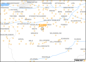
Gupf (Kärnten, Austria)Gupf is a town in the Kärnten region of Austria. An overview map of the region around Gupf is displayed below.
regional and 3d topo map of Gupf, Austria ::
Gupf airports ::
The nearest airport is KLU - Klagenfurt (Worthersee Intl), located 14.4 km north of Gupf.
Other airports nearby include LJU - Ljubliana Ljubljana (33.1 km south), GRZ - Graz (96.4 km north east), MBX - Maribor (100.1 km east), TRS - Ronchi De Legionari Ronchi Dei Legionari (104.0 km south west), Nearby towns ::
Hintergupf (0.0km north) //
Laak (2.2km north west) //
Sabosach (2.2km north east) //
Gotschuchen (2.2km north east) //
Rauth (2.6km west) //
Seidolach (3.2km north west) //
Dullach (3.9km north) //
Waidisch (3.2km south west) //
Jug (4.8km south) //
Zell-Pfarre (5.0km south) //
Zell-Pfarre (5.0km south) //
Sele-Fara (5.0km south) //
Unterguntschach (4.5km north west) //
Kobla (5.3km south) //
Sankt Margareten im Rosental (4.4km north east) //
Schwarz (5.6km north) //
Dvorec (5.6km north) //
Glainach (4.3km north west) //
Ravna (5.7km south) //
Goritschach (5.7km north) //
Zell-Homölisch (4.3km south east) //
Sele-Homeliše (4.3km south east) //
Niederdörfl (4.7km north east) //
Trieblach (5.3km north east) //
Göltschach (5.3km north west) //
Oberguntschach (5.3km north west) //
Stemeritsch (6.1km north west) //
Saberda (6.1km north west) //
Unterkreuth (6.1km north east) //
[all distances 'as the bird flies' and approximate]  Places with similar names to Gupf, Austria ::
Disclaimer :: Information on this page comes without warranty of any kind |
||
|
Where is Gupf? Elevation and coordinates ::
Latitude (lat): 46°31'0"N Longitude (lon): 14°23'0"E
Elevation (approx.): 1085m (map arrows pan, magnifying glasses zoom) |
||
|
Visiting Gupf? Hotel/Accommodation ::
Book a hotel in Gupf Travel Guide ::
Buy a travel guide for Austria rental cars ::
car rental offers GPS waypoint ::
download a GPX waypoint (PoI) of Gupf for your GPS receiver
|
||