|
search place name
|
||
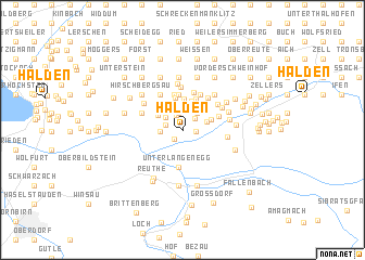
Halden (Vorarlberg, Austria)Halden is a town in the Vorarlberg region of Austria. An overview map of the region around Halden is displayed below.
regional and 3d topo map of Halden, Austria ::
Halden airports ::
The nearest airport is ACH - St Gallen Altenrhein, located 24.7 km west of Halden.
Other airports nearby include FDH - Friedrichshafen (34.0 km north west), ZRH - Zurich (100.9 km west), SMV - Samedan (107.5 km south), INN - Innsbruck (113.2 km east), Nearby towns ::
Doren (1.1km south west) //
Stein (0.9km east) //
Hompmann (1.6km north) //
Falz (1.4km north east) //
Schönenbühl (1.8km north) //
Schönengrund (1.3km north west) //
Eschau (1.8km north west) //
Sulzberg (2.0km north east) //
Rotach (1.6km west) //
Ober (1.9km north east) //
Fötschern (2.3km north west) //
Oberköhler (2.4km north east) //
Fahl (2.3km north west) //
Brucktobel (2.9km north) //
Brögen (2.3km north east) //
Ach (2.5km north west) //
Fehren am Hinterberg (3.1km north) //
Au (2.7km north west) //
Langstein (3.3km north) //
Mühlstatt (3.0km north west) //
Schützen (3.4km north) //
Oberhaus (3.3km north) //
Thal (3.6km north) //
Hagen (3.6km north) //
Kuhn (3.7km north) //
Unterlangenegg (3.8km south) //
Schüssel (2.9km north east) //
Gschwend (4.0km north) //
Eientobel (3.8km north) //
[all distances 'as the bird flies' and approximate] 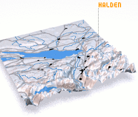 Places with similar names to Halden, Austria ::
Disclaimer :: Information on this page comes without warranty of any kind |
||
|
Where is Halden? Elevation and coordinates ::
Latitude (lat): 47°30'3"N Longitude (lon): 9°53'15"E
Elevation (approx.): 839m (map arrows pan, magnifying glasses zoom) |
||
|
Visiting Halden? Hotel/Accommodation ::
Book a hotel in Halden Travel Guide ::
Buy a travel guide for Austria rental cars ::
car rental offers GPS waypoint ::
download a GPX waypoint (PoI) of Halden for your GPS receiver
|
||