|
search place name
|
||
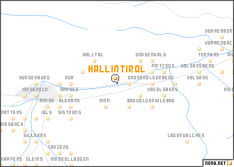
Hall in Tirol (Tirol, Austria)Hall in Tirol is a town in the Tirol region of Austria. An overview map of the region around Hall in Tirol is displayed below.
regional and 3d topo map of Hall in Tirol, Austria ::
Hall in Tirol airports ::
The nearest airport is INN - Innsbruck, located 13.3 km west of Hall in Tirol.
Other airports nearby include OBF - Oberpfaffenhofen (90.4 km north), BZO - Bolzano (92.6 km south), FEL - Fuerstenfeldbruck Furstenfeldbruck (104.2 km north), MUC - Munich Munchen (120.7 km north), Nearby towns ::
Mils bei Solbad Hall (1.3km east) //
Eichat (1.9km north) //
Absam (2.2km north west) //
Kleinvolderberg (3.1km south east) //
Tulfes (3.9km south) //
Rinn (3.9km south) //
Sankt Martin (4.5km north east) //
Halltal (4.5km north west) //
Volders (3.8km east) //
Grossvolderberg (3.8km east) //
Baumkirchen (4.2km north east) //
Thaur (4.2km north west) //
Bad Volderwildbad (5.3km south east) //
Sankt Michael (5.3km north east) //
Gnadenwald (5.3km north east) //
Rum (5.0km west) //
Vögelsberg (5.4km east) //
Fritzens (5.4km east) //
Ampass (5.4km west) //
Aldrans (6.2km south west) //
Lans (7.5km south west) //
Sistrans (7.5km south west) //
[all distances 'as the bird flies' and approximate] 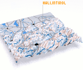 Places with similar names to Hall in Tirol, Austria :: Disclaimer :: Information on this page comes without warranty of any kind |
||
|
Where is Hall in Tirol? Elevation and coordinates ::
Latitude (lat): 47°17'0"N Longitude (lon): 11°31'0"E
Elevation (approx.): 586m (map arrows pan, magnifying glasses zoom) |
||
|
Visiting Hall in Tirol? Hotel/Accommodation ::
Book a hotel in Hall in Tirol Travel Guide ::
Buy a travel guide for Austria rental cars ::
car rental offers GPS waypoint ::
download a GPX waypoint (PoI) of Hall in Tirol for your GPS receiver
|
||