|
search place name
|
||
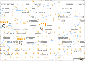
Hart (Kärnten, Austria)Hart is a town in the Kärnten region of Austria. An overview map of the region around Hart is displayed below.
regional and 3d topo map of Hart, Austria ::
Hart airports ::
The nearest airport is KLU - Klagenfurt (Worthersee Intl), located 15.9 km south east of Hart.
Other airports nearby include LJU - Ljubliana Ljubljana (63.0 km south), GRZ - Graz (93.8 km east), MBX - Maribor (114.6 km east), TRS - Ronchi De Legionari Ronchi Dei Legionari (121.0 km south west), Nearby towns ::
Grassendorf (1.2km north) //
Sörg (1.4km south east) //
Freundsam (1.5km south west) //
Gradenegg (2.5km south) //
Glantschach (2.8km south east) //
Eggen (2.8km south west) //
Liemberg (2.8km south west) //
Pflugern (2.2km east) //
Waggendorf (2.6km east) //
Schaumboden (2.8km north east) //
Zojach (2.9km north west) //
Sankt Leonhard (4.4km south) //
Pulst (3.5km south east) //
Dreifaltigkeit (3.9km north east) //
Steinbichl (4.0km north west) //
Tauchendorf (4.7km south) //
Predl (5.1km north) //
Innere Wimitz (5.1km north) //
Fachau (3.8km east) //
Liebenfels (4.7km south east) //
Feistritz (5.0km south east) //
Wasai (5.1km south west) //
Hohenstein (4.5km south east) //
Unterhaidach (6.2km south) //
Psein (5.6km north west) //
Hardegg (6.3km south) //
Wullross (4.9km north west) //
Haidach (6.4km south) //
Oberhaidach (6.4km south) //
[all distances 'as the bird flies' and approximate]  Places with similar names to Hart, Austria ::
Disclaimer :: Information on this page comes without warranty of any kind |
||
|
Where is Hart? Elevation and coordinates ::
Latitude (lat): 46°46'21"N Longitude (lon): 14°15'3"E
Elevation (approx.): 886m (map arrows pan, magnifying glasses zoom) |
||
|
Visiting Hart? Hotel/Accommodation ::
Book a hotel in Hart Travel Guide ::
Buy a travel guide for Austria rental cars ::
car rental offers GPS waypoint ::
download a GPX waypoint (PoI) of Hart for your GPS receiver
|
||