|
search place name
|
||
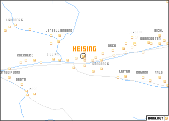
Heising (Tirol, Austria)Heising is a town in the Tirol region of Austria. An overview map of the region around Heising is displayed below.
regional and 3d topo map of Heising, Austria ::
Heising airports ::
The nearest airport is AVB - Aviano Ab (Pagliano E Gori), located 80.3 km south of Heising.
Other airports nearby include BZO - Bolzano (94.3 km west), INN - Innsbruck (103.6 km north west), SZG - Salzburg (122.5 km north), TSF - Treviso (124.5 km south), Nearby towns ::
Messensee (0.0km north) //
Hof (0.0km north) //
Strassen (0.4km north) //
Sankt Oswald (1.2km south) //
Hintenburg (1.3km east) //
Hintenburg (1.9km north) //
Panzendorf (1.4km west) //
Tessenberg (1.8km east) //
Hollbruck (2.3km south west) //
Kartitsch (2.7km south east) //
Rabland (2.5km west) //
Heinfels (2.5km west) //
Geselhaus (2.5km east) //
Oberberg (3.1km south east) //
Abfaltern (3.2km north east) //
Schlittenhaus (3.8km west) //
Abfaltersbach (4.6km east) //
Asch (4.9km north east) //
Sillian (4.8km west) //
Außervillgraten (5.7km north west) //
Versellerberg (6.7km north west) //
Unterwalden (6.3km north west) //
Äusserst (6.3km south east) //
Anras (6.5km north east) //
Unterfeld (7.5km north west) //
[all distances 'as the bird flies' and approximate]  Places with similar names to Heising, Austria ::
Disclaimer :: Information on this page comes without warranty of any kind |
||
|
Where is Heising? Elevation and coordinates ::
Latitude (lat): 46°45'0"N Longitude (lon): 12°29'0"E
Elevation (approx.): 1081m (map arrows pan, magnifying glasses zoom) |
||
|
Visiting Heising? Hotel/Accommodation ::
Book a hotel in Heising Travel Guide ::
Buy a travel guide for Austria rental cars ::
car rental offers GPS waypoint ::
download a GPX waypoint (PoI) of Heising for your GPS receiver
|
||