|
search place name
|
||
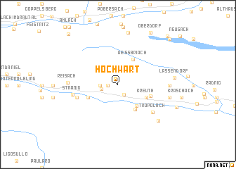
Hochwart (Kärnten, Austria)Hochwart is a town in the Kärnten region of Austria. An overview map of the region around Hochwart is displayed below.
regional and 3d topo map of Hochwart, Austria ::
Hochwart airports ::
The nearest airport is AVB - Aviano Ab (Pagliano E Gori), located 84.2 km south west of Hochwart.
Other airports nearby include KLU - Klagenfurt (Worthersee Intl) (85.1 km east), TRS - Ronchi De Legionari Ronchi Dei Legionari (93.6 km south), LJU - Ljubliana Ljubljana (106.0 km south east), SZG - Salzburg (128.0 km north), Nearby towns ::
Kirchbach (1.1km west) //
Weidegg (1.8km south) //
Tressdorf (1.9km west) //
Stöfflerberg (2.0km west) //
Rattendorf (4.0km south east) //
Weissbriach (4.2km north) //
Jenig (4.3km south east) //
Kreuth (3.7km south east) //
Unterdöbernitzen (3.8km south west) //
Kleinbergl (4.0km south east) //
Oberdöbernitzen (5.0km south west) //
Tröpolach (5.8km south east) //
Stranig (5.2km west) //
Reisach (5.5km west) //
Sankt Lorenzen im Gitschtal (5.7km east) //
Kreuzberg (8.3km north) //
Guggenberg (6.0km east) //
Schlanitzen (7.3km south east) //
Oberdorf (9.0km north east) //
Gatschach (9.2km north east) //
Techendorf (9.3km north east) //
Egg (9.7km north west) //
[all distances 'as the bird flies' and approximate]  Places with similar names to Hochwart, Austria ::
// Hochwart (AT)
// Ḩawsh Wārid (LY)
Disclaimer :: Information on this page comes without warranty of any kind |
||
|
Where is Hochwart? Elevation and coordinates ::
Latitude (lat): 46°39'7"N Longitude (lon): 13°13'33"E
Elevation (approx.): 1191m (map arrows pan, magnifying glasses zoom) |
||
|
Visiting Hochwart? Hotel/Accommodation ::
Book a hotel in Hochwart Travel Guide ::
Buy a travel guide for Austria rental cars ::
car rental offers GPS waypoint ::
download a GPX waypoint (PoI) of Hochwart for your GPS receiver
|
||