|
search place name
|
||
Hochwarth (Steiermark, Austria)Hochwarth is a town in the Steiermark region of Austria. An overview map of the region around Hochwarth is displayed below.
regional and 3d topo map of Hochwarth, Austria ::

Hochwarth airports ::
The nearest airport is MBX - Maribor, located 38.4 km south west of Hochwarth.
Other airports nearby include GRZ - Graz (47.3 km north west), ZAG - Zagreb (114.1 km south), KLU - Klagenfurt (Worthersee Intl) (125.3 km west), LJU - Ljubliana Ljubljana (130.6 km south west), Nearby towns ::
Ölberg (0.0km north) //
Klinzl (0.0km north) //
Klöch (0.2km south) //
Gruisla (1.3km east) //
Pichla bei Radkersburg (1.9km north) //
Buchberg (1.9km north) //
Kratzer (1.9km north) //
Zaraberg (1.3km west) //
Pöhrl (1.3km west) //
Jörgen (1.3km west) //
Klöchberg (1.3km west) //
Seindl (1.3km west) //
Deutsch Haseldorf (2.1km north) //
Rosenberg (2.2km north east) //
Rosenberg (2.2km north east) //
Tratten (2.2km north west) //
Dirneck (2.2km north west) //
Reichel (2.2km north west) //
Eselberg (2.2km north west) //
Königsberg (2.2km north west) //
Pirchweingarten (2.2km south east) //
Tieschen (2.9km north west) //
Globitsch (3.7km north) //
Kerschenberg (3.7km north) //
Hürtherberg (2.5km west) //
Süßegg (2.5km west) //
Kreuzberg (2.5km west) //
Pölten (3.7km south) //
Klapping (3.9km north) //
[all distances 'as the bird flies' and approximate] 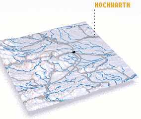 Places with similar names to Hochwarth, Austria :: Disclaimer :: Information on this page comes without warranty of any kind |
||
|
Where is Hochwarth? Elevation and coordinates ::
Latitude (lat): 46°46'0"N Longitude (lon): 15°58'0"E
Elevation (approx.): 331m (map arrows pan, magnifying glasses zoom) |
||
|
Visiting Hochwarth? Hotel/Accommodation ::
Book a hotel in Hochwarth Travel Guide ::
Buy a travel guide for Austria rental cars ::
car rental offers GPS waypoint ::
download a GPX waypoint (PoI) of Hochwarth for your GPS receiver
|
||