|
search place name
|
||
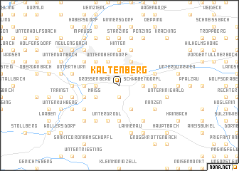
Kaltenberg (Niederösterreich, Austria)Kaltenberg is a town in the Niederösterreich region of Austria. An overview map of the region around Kaltenberg is displayed below.
regional and 3d topo map of Kaltenberg, Austria ::
nearby GPS traces from timatio ::
Kaltenberg airports ::
The nearest airport is VIE - Vienna Schwechat, located 45.1 km east of Kaltenberg.
Other airports nearby include BTS - Bratislava M R Stefanik (92.7 km east), BRQ - Turany (123.6 km north east), LNZ - Linz (Horsching) (132.6 km west), GRZ - Graz (134.8 km south), Nearby towns ::
Hochstrass (1.9km south) //
Ottenheim (2.2km north east) //
Eichgraben (2.2km north east) //
Götzwiesen (2.2km north west) //
Knagg (2.2km north west) //
Schwabendörfl (2.5km east) //
Grossenberg (2.5km west) //
Lengbachl (3.9km south) //
Hutten (3.9km north) //
Unteroberndorf (3.9km north) //
Maiss (3.1km south west) //
Grossrassberg (4.5km north west) //
Schöpflgitter (5.6km south) //
Oberkniewald (3.7km east) //
Altlengbach (3.7km west) //
Winten (5.6km north) //
Dornberg (5.7km north) //
Untergrödl (5.7km south) //
Gaisrücken (5.7km south) //
Linden (4.1km south west) //
Rekawinkel (4.1km north east) //
Neustift bei Altlengbach (4.1km south west) //
Ranzen (5.2km south east) //
Innerfurth (5.2km south west) //
Kleinkrottenbach (6.1km south east) //
Maria Anzbach (5.2km north west) //
Obergrödl (6.1km south west) //
Aschberg (4.9km west) //
Starzing (7.4km north) //
[all distances 'as the bird flies' and approximate] 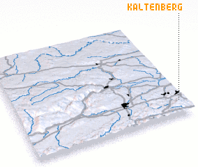 Places with similar names to Kaltenberg, Austria ::
// Glattenberg (CH)
// Kaltenberg (AT)
// Kaltenberg (AT)
// Kaltenberg (AT)
// Kaltenberg (AT)
// Kaltenberg (AT)
// Goldenberg (DE)
// Kaltenberg (DE)
// Kaltenberg (DE)
// Kaltenberg (DE)
Disclaimer :: Information on this page comes without warranty of any kind |
||
|
Where is Kaltenberg? Elevation and coordinates ::
Latitude (lat): 48°9'0"N Longitude (lon): 15°58'0"E
Elevation (approx.): 391m (map arrows pan, magnifying glasses zoom) |
||
|
Visiting Kaltenberg? Hotel/Accommodation ::
Book a hotel in Kaltenberg Travel Guide ::
Buy a travel guide for Austria rental cars ::
car rental offers GPS waypoint ::
download a GPX waypoint (PoI) of Kaltenberg for your GPS receiver
|
||