|
search place name
|
||
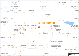
Klein-Schweinbarth (Niederösterreich, Austria)Klein-Schweinbarth is a town in the Niederösterreich region of Austria. An overview map of the region around Klein-Schweinbarth is displayed below.
regional and 3d topo map of Klein-Schweinbarth, Austria ::
Klein-Schweinbarth airports ::
The nearest airport is BRQ - Turany, located 45.2 km north of Klein-Schweinbarth.
Other airports nearby include VIE - Vienna Schwechat (71.2 km south), BTS - Bratislava M R Stefanik (78.8 km south east), PZY - Piestany (91.5 km east), PRV - Prerov (95.4 km north east), Nearby towns ::
Guttenbrunn (1.2km west) //
Himmel (1.5km west) //
Stützenhofen (2.2km south east) //
Ottenthal (2.4km west) //
Poysbrunn (3.9km south) //
Falkenstein (3.9km south) //
Drasenhofen (3.7km east) //
Mikulov (6.1km north east) //
Steinebrunn (4.9km east) //
Pottenhofen (4.9km west) //
Waldsts(251)tten (5.4km west) //
Březí (7.8km north) //
Föllim (7.8km south) //
Zlabern (6.1km south west) //
Altruppersdorf (8.3km south west) //
Dobré Pole (8.9km north west) //
[all distances 'as the bird flies' and approximate] 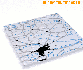 Places with similar names to Klein-Schweinbarth, Austria :: Disclaimer :: Information on this page comes without warranty of any kind |
||
|
Where is Klein-Schweinbarth? Elevation and coordinates ::
Latitude (lat): 48°45'0"N Longitude (lon): 16°36'0"E
Elevation (approx.): 297m (map arrows pan, magnifying glasses zoom) |
||
|
Visiting Klein-Schweinbarth? Hotel/Accommodation ::
Book a hotel in Klein-Schweinbarth Travel Guide ::
Buy a travel guide for Austria rental cars ::
car rental offers GPS waypoint ::
download a GPX waypoint (PoI) of Klein-Schweinbarth for your GPS receiver
|
||