|
search place name
|
||
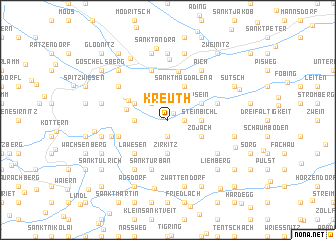
Kreuth (Kärnten, Austria)Kreuth is a town in the Kärnten region of Austria. An overview map of the region around Kreuth is displayed below.
regional and 3d topo map of Kreuth, Austria ::
Kreuth airports ::
The nearest airport is KLU - Klagenfurt (Worthersee Intl), located 21.1 km south east of Kreuth.
Other airports nearby include LJU - Ljubliana Ljubljana (67.4 km south), GRZ - Graz (98.1 km east), MBX - Maribor (120.4 km east), TRS - Ronchi De Legionari Ronchi Dei Legionari (121.2 km south west), Nearby towns ::
Dalling (0.6km north west) //
Planitz (0.9km north east) //
Sankt Paul (1.9km south) //
Wullross (1.3km east) //
Kötschendorf (2.2km north west) //
Zirkitz (3.7km south) //
Goggau (2.5km west) //
Steinbichl (2.5km east) //
Zammelsberg (3.1km north west) //
Sankt Magdalena (3.9km north) //
Zojach (3.1km south east) //
Psein (3.1km north east) //
Edling (3.4km west) //
Oberort (3.8km north west) //
Lawesen (4.5km south west) //
Weitensfeld (5.5km north) //
Kaindorf (5.7km north) //
Sankt Urban (5.7km south) //
Altenmarkt (5.7km north) //
Niederwinklern (4.2km south west) //
Innere Wimitz (4.2km north east) //
Rennweg (4.7km south west) //
Bach (6.1km south west) //
Freundsam (5.3km south east) //
Braunsberg (5.3km north west) //
Aich (6.1km north east) //
Sadin (6.8km north) //
Nassing (7.4km north) //
Unterhof (5.4km west) //
[all distances 'as the bird flies' and approximate]  Places with similar names to Kreuth, Austria ::
Disclaimer :: Information on this page comes without warranty of any kind |
||
|
Where is Kreuth? Elevation and coordinates ::
Latitude (lat): 46°48'0"N Longitude (lon): 14°11'0"E
Elevation (approx.): 874m (map arrows pan, magnifying glasses zoom) |
||
|
Visiting Kreuth? Hotel/Accommodation ::
Book a hotel in Kreuth Travel Guide ::
Buy a travel guide for Austria rental cars ::
car rental offers GPS waypoint ::
download a GPX waypoint (PoI) of Kreuth for your GPS receiver
|
||