|
search place name
|
||
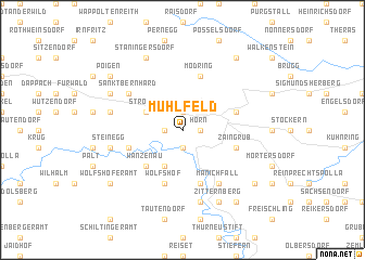
Mühlfeld (Niederösterreich, Austria)Mühlfeld is a town in the Niederösterreich region of Austria. An overview map of the region around Mühlfeld is displayed below.
regional and 3d topo map of Mühlfeld, Austria ::
nearby GPS traces from timatio ::
Mühlfeld airports ::
The nearest airport is VIE - Vienna Schwechat, located 91.7 km south east of Mühlfeld.
Other airports nearby include BRQ - Turany (95.7 km north east), LNZ - Linz (Horsching) (116.6 km south west), BTS - Bratislava M R Stefanik (128.5 km south east), PED - Pardubice (151.8 km north), Nearby towns ::
Burgerwiesen (1.2km west) //
Horn (1.2km east) //
Frauenhofen (1.9km north) //
Rosenburg (1.9km south) //
Etzmannsdorf am Kamp (3.9km south) //
Strögen (3.1km north west) //
Wanzenau (4.4km south west) //
Wolfshof (5.7km south) //
Kamegg (5.7km south) //
Mold (4.1km south east) //
Zaingrub (4.1km south east) //
Breiteneich (4.1km north east) //
Altenburg (4.1km south west) //
Mödring (5.7km north) //
Sankt Bernhard (5.2km north west) //
Manichfall (6.1km south east) //
Grossburgstall (5.2km west) //
Steinegg (5.2km west) //
Mahrersdorf (5.2km west) //
Gars am Kamp (7.5km south) //
Thunau am Kamp (7.5km south) //
Neukirchen an der Wild (6.1km north west) //
Staningersdorf (7.8km north) //
Zitternberg (7.8km south) //
Wolfshoferamt (7.4km south west) //
Poigen (7.4km north west) //
Nondorf bei Gars (7.4km south east) //
Maiersch (8.3km south east) //
Lehndorf (8.3km north east) //
[all distances 'as the bird flies' and approximate] 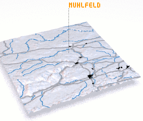 Places with similar names to Mühlfeld, Austria ::
// Mühlfeld (AT)
// Mühlfeld (AT)
// Mühlfeld (DE)
// Mühlfeld (DE)
// Mühlfeld (DE)
// Millfield (US)
// Mala Falda (HN)
// Malvalette (FR)
// Muille-Villette (FR)
// Millfield (AU)
Disclaimer :: Information on this page comes without warranty of any kind |
||
|
Where is Mühlfeld? Elevation and coordinates ::
Latitude (lat): 48°39'0"N Longitude (lon): 15°38'0"E
Elevation (approx.): 337m (map arrows pan, magnifying glasses zoom) |
||
|
Visiting Mühlfeld? Hotel/Accommodation ::
Book a hotel in Mühlfeld Travel Guide ::
Buy a travel guide for Austria rental cars ::
car rental offers GPS waypoint ::
download a GPX waypoint (PoI) of Mühlfeld for your GPS receiver
|
||