|
search place name
|
||
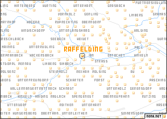
Raffelding (Oberösterreich, Austria)Raffelding is a town in the Oberösterreich region of Austria. An overview map of the region around Raffelding is displayed below.
regional and 3d topo map of Raffelding, Austria ::
Raffelding airports ::
The nearest airport is LNZ - Linz (Horsching), located 12.6 km south east of Raffelding.
Other airports nearby include SZG - Salzburg (96.2 km south west), GRZ - Graz (179.1 km south east), KLU - Klagenfurt (Worthersee Intl) (185.6 km south), PRG - Prague Ruzyne (200.9 km north), Nearby towns ::
Taubenbrunn (0.0km north) //
Staudach (1.9km south) //
Unterhillinglah (1.2km west) //
Inn (1.2km east) //
Unterschaden (1.9km north) //
Oberschaden (1.9km north) //
Emling (2.2km south east) //
Fraham (2.2km south west) //
Oberhartheim (2.2km south east) //
Rexham (3.7km south) //
Oberhillinglah (2.5km west) //
Weidet (3.7km north) //
Puchham (3.9km south) //
Strass (3.1km south east) //
Simbach (3.1km south west) //
Eferding (3.1km north west) //
Straß (3.0km south east) //
Polsing (4.5km south east) //
Leppersdorf (4.5km south west) //
Brandstatt (4.5km north west) //
Polsenz (3.7km west) //
Feldkirchen an der Donau (5.6km north) //
Weidach (4.1km south east) //
Alkoven (4.1km south east) //
Scharten (5.7km south) //
Hörstorf (4.1km south west) //
Hinzenbach (4.1km north west) //
Unterlandshaag (5.7km north) //
Oberlandshaag (5.7km north) //
[all distances 'as the bird flies' and approximate]  Places with similar names to Raffelding, Austria ::
// Raffolding (DE)
// Reiflding (DE)
Disclaimer :: Information on this page comes without warranty of any kind |
||
|
Where is Raffelding? Elevation and coordinates ::
Latitude (lat): 48°18'0"N Longitude (lon): 14°3'0"E
Elevation (approx.): 261m (map arrows pan, magnifying glasses zoom) |
||
|
Visiting Raffelding? Hotel/Accommodation ::
Book a hotel in Raffelding Travel Guide ::
Buy a travel guide for Austria rental cars ::
car rental offers GPS waypoint ::
download a GPX waypoint (PoI) of Raffelding for your GPS receiver
|
||