|
search place name
|
||
Rafings (Niederösterreich, Austria)Rafings is a town in the Niederösterreich region of Austria. An overview map of the region around Rafings is displayed below.
regional and 3d topo map of Rafings, Austria ::

Rafings airports ::
The nearest airport is LNZ - Linz (Horsching), located 102.5 km south west of Rafings.
Other airports nearby include BRQ - Turany (110.0 km east), VIE - Vienna Schwechat (120.1 km south east), PED - Pardubice (140.5 km north), BTS - Bratislava M R Stefanik (157.0 km south east), Nearby towns ::
Rafingsberg (1.9km south) //
Vestenpoppen (1.9km north) //
Ulrichschlag (1.2km east) //
Meires (1.2km west) //
Lichtenberg (1.2km east) //
Markl (2.2km south west) //
Willings (2.2km south west) //
Windigsteig (2.2km south west) //
Wohlfahrts (2.2km north west) //
Edengans (2.4km west) //
Matzlesschlag (3.7km south) //
Altwaidhofen (3.7km north) //
Kottschallings (3.1km south west) //
Jassnitz (3.1km north west) //
Götzweis (3.1km north west) //
Waldberg (3.9km south) //
Waidhofen an der Thaya (3.9km north) //
Weinpolz (4.4km south east) //
Limpfings (4.4km south west) //
Matzles (4.4km north east) //
Vestennötting (5.6km north) //
Götzles (3.7km east) //
Grünau (3.7km west) //
Stögersbach (5.6km south) //
Georgenberg (4.1km south east) //
Kleinreichenbach (4.1km south west) //
Jarolden (5.7km north) //
Kainraths (4.1km north west) //
Hausbach (5.7km south) //
[all distances 'as the bird flies' and approximate] 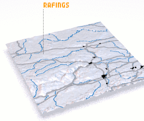 Places with similar names to Rafings, Austria ::
// Ravinia Oaks (US)
Disclaimer :: Information on this page comes without warranty of any kind |
||
|
Where is Rafings? Elevation and coordinates ::
Latitude (lat): 48°47'0"N Longitude (lon): 15°18'0"E
Elevation (approx.): 523m (map arrows pan, magnifying glasses zoom) |
||
|
Visiting Rafings? Hotel/Accommodation ::
Book a hotel in Rafings Travel Guide ::
Buy a travel guide for Austria rental cars ::
car rental offers GPS waypoint ::
download a GPX waypoint (PoI) of Rafings for your GPS receiver
|
||