|
search place name
|
||
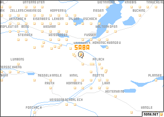
Saba (Tirol, Austria)Saba is a town in the Tirol region of Austria. An overview map of the region around Saba is displayed below.
regional and 3d topo map of Saba, Austria ::
Saba airports ::
The nearest airport is INN - Innsbruck, located 58.2 km south east of Saba.
Other airports nearby include OBF - Oberpfaffenhofen (76.3 km north east), ACH - St Gallen Altenrhein (84.6 km west), FEL - Fuerstenfeldbruck Furstenfeldbruck (87.2 km north east), FDH - Friedrichshafen (89.4 km west), Nearby towns ::
Oberpinswang (0.6km north) //
Rossschläg (1.2km south) //
Brandstatt (1.2km south) //
Musau (1.3km north west) //
Unterpinswang (1.3km north west) //
Greng (1.6km north west) //
Oberletzen (1.9km south east) //
Unterletzen (1.9km south east) //
Weißhaus (2.4km north) //
Wiesbichlsiedlung (2.1km south east) //
Stegen (2.9km north west) //
Hinterbichl (3.4km south east) //
Pflach (2.9km south east) //
Bad Faulenbach (4.3km north) //
Füssen (4.5km north) //
Wängle (4.9km south) //
Hüttenbichl (3.7km south east) //
Winkl (5.1km south) //
Lechaschau (5.1km south) //
Moos (4.9km north west) //
Oberried (4.9km north west) //
Krotemoossiedlung (4.5km north west) //
Horn (5.1km north east) //
Vils (4.4km north west) //
Archbach Siedlung (4.6km south east) //
Doktor Schwarzkopf-Siedlung (4.8km south east) //
Hohenschwangau (4.6km north east) //
Reutte (5.6km south east) //
Mühlviertel (5.0km north west) //
[all distances 'as the bird flies' and approximate] 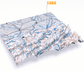 Places with similar names to Saba, Austria ::
Disclaimer :: Information on this page comes without warranty of any kind |
||
|
Where is Saba? Elevation and coordinates ::
Latitude (lat): 47°31'40"N Longitude (lon): 10°40'53"E
Elevation (approx.): 833m (map arrows pan, magnifying glasses zoom) |
||
|
Visiting Saba? Hotel/Accommodation ::
Book a hotel in Saba Travel Guide ::
Buy a travel guide for Austria rental cars ::
car rental offers GPS waypoint ::
download a GPX waypoint (PoI) of Saba for your GPS receiver
|
||