|
search place name
|
||
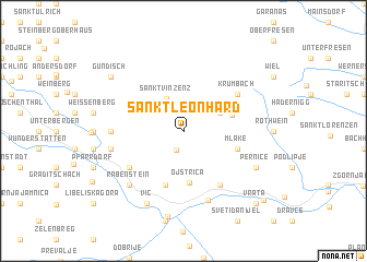
Sankt Leonhard (Steiermark, Austria)Sankt Leonhard is a town in the Steiermark region of Austria. An overview map of the region around Sankt Leonhard is displayed below.
regional and 3d topo map of Sankt Leonhard, Austria ::
Sankt Leonhard airports ::
The nearest airport is GRZ - Graz, located 47.6 km north east of Sankt Leonhard.
Other airports nearby include KLU - Klagenfurt (Worthersee Intl) (53.3 km west), MBX - Maribor (54.2 km east), LJU - Ljubliana Ljubljana (66.2 km south west), ZAG - Zagreb (130.1 km south east), Nearby towns ::
(( Rosshütte )) (2.0km south) //
Sankt Vinzenz (3.5km north) //
Sankt Jakob (3.1km north east) //
Soboth (3.8km north east) //
Ojstrica (5.3km south) //
Goriški Vrh (5.7km south) //
Mlake (4.2km south east) //
Laaken (4.2km south east) //
Krumbach (5.3km north east) //
Kozji Vrh nad Dravogradom (6.1km south east) //
Lorenzenberg (5.3km south west) //
Lamprechtsberg (5.1km west) //
Sveti Boštjan (7.3km south) //
Magdalensberg (5.4km west) //
Rabenstein (6.7km south west) //
Vič (7.8km south) //
Pernice (6.3km south east) //
Dravograd (8.8km south) //
Gundisch (7.5km north west) //
Vrata (9.0km south east) //
Trbonje (9.1km south east) //
[all distances 'as the bird flies' and approximate] 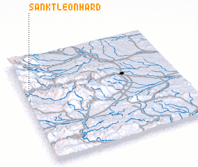 Places with similar names to Sankt Leonhard, Austria ::
// Sankt Leonhard (AT)
// Sankt Leonhard (AT)
// Sankt Leonhard (AT)
// Sankt Leonhard (AT)
// Sankt Leonhard (AT)
// Sankt Leonhard (AT)
// Sankt Leonhard (AT)
// Sankt Leonhard (DE)
// Sankt Leonhard (DE)
// Sankt Leonhard (DE)
Disclaimer :: Information on this page comes without warranty of any kind |
||
|
Where is Sankt Leonhard? Elevation and coordinates ::
Latitude (lat): 46°40'0"N Longitude (lon): 15°2'0"E
Elevation (approx.): 1094m (map arrows pan, magnifying glasses zoom) |
||
|
Visiting Sankt Leonhard? Hotel/Accommodation ::
Book a hotel in Sankt Leonhard Travel Guide ::
Buy a travel guide for Austria rental cars ::
car rental offers GPS waypoint ::
download a GPX waypoint (PoI) of Sankt Leonhard for your GPS receiver
|
||