|
search place name
|
||
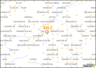
Sulz (Niederösterreich, Austria)Sulz is a town in the Niederösterreich region of Austria. An overview map of the region around Sulz is displayed below.
regional and 3d topo map of Sulz, Austria ::
Sulz airports ::
The nearest airport is LNZ - Linz (Horsching), located 68.4 km south west of Sulz.
Other airports nearby include VIE - Vienna Schwechat (139.7 km south east), BRQ - Turany (145.1 km north east), PED - Pardubice (164.3 km north), PRG - Prague Ruzyne (167.3 km north), Nearby towns ::
Walterschlag (1.2km east) //
Oberlainsitz (1.2km west) //
Zeil (1.2km west) //
Seifritz (1.9km south) //
Mühlbach (1.9km south) //
Sankt Wolfgang (2.2km north east) //
Watzmanns (2.2km south east) //
Harmannstein (2.4km east) //
Schützenberg (3.7km north) //
Sankt Martin (2.4km west) //
Nondorf (3.9km south) //
Abschlag (3.9km south) //
Spiegelhof (3.9km south) //
Weikertschlag (3.9km south) //
Oberwindhag (3.1km north east) //
Schöllbüchl (3.9km north) //
Langfeld (3.9km north) //
Rossbruck (3.1km north west) //
Steinbach (3.1km south west) //
Münzbach (5.6km south) //
Streith (5.7km south) //
Stierberg (5.7km south) //
Weitra (5.7km north) //
Grosspertholz (4.1km south west) //
Scheiben (5.2km south west) //
Siebenberg (6.1km south east) //
Mittelberg (6.1km south east) //
Wachtberg (5.2km south east) //
Wultschau (5.2km north west) //
[all distances 'as the bird flies' and approximate] 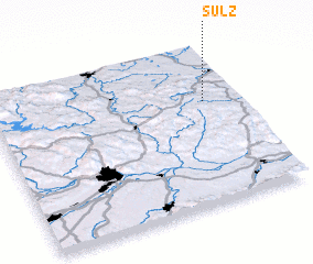 Places with similar names to Sulz, Austria ::
Disclaimer :: Information on this page comes without warranty of any kind |
||
|
Where is Sulz? Elevation and coordinates ::
Latitude (lat): 48°39'0"N Longitude (lon): 14°52'0"E
Elevation (approx.): 730m (map arrows pan, magnifying glasses zoom) |
||
|
Visiting Sulz? Hotel/Accommodation ::
Book a hotel in Sulz Travel Guide ::
Buy a travel guide for Austria rental cars ::
car rental offers GPS waypoint ::
download a GPX waypoint (PoI) of Sulz for your GPS receiver
|
||