|
search place name
|
||
Wiegen (Kärnten, Austria)Wiegen is a town in the Kärnten region of Austria. An overview map of the region around Wiegen is displayed below.
regional and 3d topo map of Wiegen, Austria ::

Wiegen airports ::
The nearest airport is KLU - Klagenfurt (Worthersee Intl), located 38.2 km south of Wiegen.
Other airports nearby include GRZ - Graz (79.1 km east), LJU - Ljubliana Ljubljana (84.6 km south), MBX - Maribor (113.1 km south east), SZG - Salzburg (138.6 km north west), Nearby towns ::
Dürnstein in der Steiermark (0.8km north west) //
Hartmannsdorf (1.9km south) //
Oberdorf (1.3km east) //
Guldendorf (1.3km west) //
Oberdorf (1.9km north) //
Einöd (1.9km north) //
Mayerhofen (1.7km south west) //
Engelsdorf (2.2km south west) //
Gaisberg (2.2km south east) //
Friesach (3.2km south) //
Schratzbach (2.7km north west) //
Wildbad Einöd (3.7km north) //
Zeltschach (3.1km south east) //
Sankt Stefan (3.1km south west) //
Mayerhofen (3.1km south west) //
Dörfl (3.9km south) //
Olsa (3.9km south) //
Sankt Salvator (3.6km south west) //
Alpl (4.5km north east) //
Gunzenberg (3.8km west) //
Sankt Johann (4.2km south west) //
Grafendorf (5.7km south) //
Pöllau (5.7km north) //
Schödendorf (6.4km south) //
Dobersberg (6.7km south) //
Velden (6.3km north east) //
Gulitzen (6.5km south east) //
Pabenberg (5.5km south east) //
Micheldorf (7.5km south) //
[all distances 'as the bird flies' and approximate] 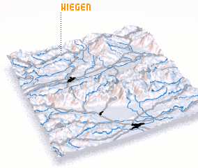 Places with similar names to Wiegen, Austria ::
Disclaimer :: Information on this page comes without warranty of any kind |
||
|
Where is Wiegen? Elevation and coordinates ::
Latitude (lat): 46°59'0"N Longitude (lon): 14°24'0"E
Elevation (approx.): 730m (map arrows pan, magnifying glasses zoom) |
||
|
Visiting Wiegen? Hotel/Accommodation ::
Book a hotel in Wiegen Travel Guide ::
Buy a travel guide for Austria rental cars ::
car rental offers GPS waypoint ::
download a GPX waypoint (PoI) of Wiegen for your GPS receiver
|
||