|
search place name
|
||
Agenbach (Baden-Württemberg, Germany)Agenbach is a town in the Baden-Württemberg region of Germany. An overview map of the region around Agenbach is displayed below.
regional and 3d topo map of Agenbach, Germany ::

Agenbach airports ::
The nearest airport is ZCC - Baden-baden Baden Oos, located 30.9 km west of Agenbach.
Other airports nearby include STR - Stuttgart (47.0 km east), ZQC - Speyer (67.7 km north), SXB - Strassbourg Entzheim (72.7 km west), ZQL - Donaueschingen Villingen (80.9 km south), Nearby towns ::
Meistern (3.1km south west) //
Neuweiler (3.9km south) //
Naislach (3.1km north east) //
Hünerberg (4.4km south west) //
Oberkollwangen (4.4km south east) //
Christophshof (3.7km west) //
Hofstett (5.6km south) //
Würzbach (4.1km north east) //
Hochwiese (5.2km north west) //
Bad Wildbad im Schwarzwald (6.1km north west) //
Breitenberg (5.2km south east) //
Zwerenberg (7.4km south) //
Spießfeld (7.5km north) //
Calmbach (7.5km north) //
Schmieh (5.2km east) //
Aichelberg (6.1km south west) //
Siehdichfür (6.1km north east) //
Gaugenwald (7.8km south) //
Oberweiler (8.3km south west) //
Aichhalden (8.3km south west) //
Martinsmoos (8.3km south east) //
[all distances 'as the bird flies' and approximate] 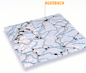 Places with similar names to Agenbach, Germany :: Disclaimer :: Information on this page comes without warranty of any kind |
||
|
Where is Agenbach? Elevation and coordinates ::
Latitude (lat): 48°42'0"N Longitude (lon): 8°35'0"E
Elevation (approx.): 761m (map arrows pan, magnifying glasses zoom) |
||
|
Visiting Agenbach? Hotel/Accommodation ::
Book a hotel in Agenbach Travel Guide ::
Buy a travel guide for Germany rental cars ::
car rental offers GPS waypoint ::
download a GPX waypoint (PoI) of Agenbach for your GPS receiver
|
||