|
search place name
|
||
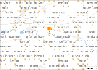
Ahe (Niedersachsen, Germany)Ahe is a town in the Niedersachsen region of Germany. An overview map of the region around Ahe is displayed below.
regional and 3d topo map of Ahe, Germany ::
Ahe airports ::
The nearest airport is HAJ - Hannover, located 47.8 km north east of Ahe.
Other airports nearby include GUT - Guetersloh Gutersloh (64.7 km south west), PAD - Paderborn Lippstadt (73.2 km south west), ZCN - Celle (74.7 km north east), KSF - Kassel Calden (87.6 km south), Nearby towns ::
Kohlenstädt (0.0km north) //
Hohenrode (0.0km north) //
Kleinenwieden (1.1km east) //
Westendorf (1.9km north) //
Strücken (2.2km south west) //
Deckbergen (2.2km north east) //
Wennenkamp (3.7km south) //
Saarbeck (2.9km south west) //
Rosenthal (2.9km north east) //
Ostendorf (2.9km north east) //
Weseberg (3.9km south) //
Bernsen (3.9km north) //
Steinbergen (4.3km north west) //
Großenwieden (3.9km south east) //
Rolfshagen (5.7km north) //
Westernholz (5.7km north) //
Schaumburg (3.9km north east) //
Engern (3.9km north west) //
Rott (5.7km south) //
Nösingfeld (5.7km south) //
Friedrichswald (5.7km south) //
Borstel (6.0km north) //
Osterfelde (6.0km north) //
Buchholz (6.0km north) //
Rumbeck (5.0km south east) //
Friedrichshöhe (5.0km south west) //
Uchtdorf (5.0km south west) //
Klein Heßlingen (6.0km south) //
Friedrichsburg (6.0km south) //
[all distances 'as the bird flies' and approximate]  Places with similar names to Ahe, Germany ::
Disclaimer :: Information on this page comes without warranty of any kind |
||
|
Where is Ahe? Elevation and coordinates ::
Latitude (lat): 52°11'0"N Longitude (lon): 9°9'0"E
Elevation (approx.): 53m (map arrows pan, magnifying glasses zoom) |
||
|
Visiting Ahe? Hotel/Accommodation ::
Book a hotel in Ahe Travel Guide ::
Buy a travel guide for Germany rental cars ::
car rental offers GPS waypoint ::
download a GPX waypoint (PoI) of Ahe for your GPS receiver
|
||