|
search place name
|
||
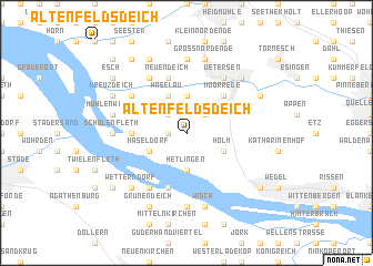
Altenfeldsdeich (Schleswig-Holstein, Germany)Altenfeldsdeich is a town in the Schleswig-Holstein region of Germany. An overview map of the region around Altenfeldsdeich is displayed below.
regional and 3d topo map of Altenfeldsdeich, Germany ::
Altenfeldsdeich airports ::
The nearest airport is XFW - Hamburg Finkenwerder, located 17.3 km south east of Altenfeldsdeich.
Other airports nearby include HAM - Hamburg (23.5 km east), BRV - Bremerhaven (71.6 km west), LBC - Luebeck Lubeck Blankensee (74.2 km east), BRE - Bremen (86.2 km south west), Nearby towns ::
Roßsteert (1.1km west) //
Haseldorfer Kamperrege (2.2km north west) //
Haselauer Kamperrege (2.2km north west) //
Heist (2.2km north east) //
Hetlingen (3.7km south) //
Bauland (3.7km north) //
Haseldorf (2.9km south west) //
Holm (2.9km south east) //
Klevendeich (3.9km north) //
Haselau (3.9km north) //
Heidrege (4.3km north east) //
Düneck (4.3km north east) //
Moorrege (4.3km north east) //
Deichreihe (3.3km west) //
Mojenhörn (5.7km south) //
Rosengarten (5.7km north) //
Neuendeich (5.7km north) //
Huttfleth (6.0km south) //
Schadendorf (6.0km north) //
Altendeich (5.0km north west) //
Uetersen (6.0km north) //
Lühedeich (7.4km south) //
Höhen (7.4km south) //
Scholenfleth (4.4km west) //
Lander (7.4km north) //
Wisch (7.5km south) //
Lühe (7.5km south) //
Mühlenwurth (4.8km north west) //
Hohenhorst (4.8km north west) //
[all distances 'as the bird flies' and approximate] 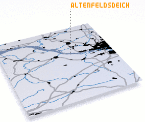 Places with similar names to Altenfeldsdeich, Germany ::
// Altenfeldsdeich (DE)
Disclaimer :: Information on this page comes without warranty of any kind |
||
|
Where is Altenfeldsdeich? Elevation and coordinates ::
Latitude (lat): 53°38'0"N Longitude (lon): 9°38'0"E
(map arrows pan, magnifying glasses zoom) |
||
|
Visiting Altenfeldsdeich? Hotel/Accommodation ::
Book a hotel in Altenfeldsdeich Travel Guide ::
Buy a travel guide for Germany rental cars ::
car rental offers GPS waypoint ::
download a GPX waypoint (PoI) of Altenfeldsdeich for your GPS receiver
|
||