|
search place name
|
||
Altenohr (Niedersachsen, Germany)Altenohr is a town in the Niedersachsen region of Germany. An overview map of the region around Altenohr is displayed below.
regional and 3d topo map of Altenohr, Germany ::

Altenohr airports ::
The nearest airport is EME - Emden, located 57.0 km north of Altenohr.
Other airports nearby include GRQ - Groningen Eelde (57.0 km north west), ENS - Enschede Twenthe (75.0 km south west), WVN - Wilhelmshaven Mariensiel (84.3 km north east), FMO - Muenster/osnabrueck Munster Osnabruck (86.7 km south), Nearby towns ::
Melstrup (1.9km north) //
Lathen (2.2km south west) //
Fresenburg (2.2km west) //
Suddenburg (3.7km north) //
Kluse (3.7km north) //
Kathen-Frackel (3.9km south) //
Düthe (2.9km north west) //
Wahn (4.3km south east) //
Beckhusen (5.6km north) //
Ahlen (5.7km north) //
Renkenberge (3.8km north east) //
Niederlangen (5.0km south west) //
Rupennest (5.0km south east) //
Steinbild (6.0km north) //
Kathenmoor (6.0km south) //
Sustrum (5.0km north west) //
Erdhütte (4.5km west) //
Dörpen (7.5km north) //
Müll (7.5km north) //
Hilter (6.5km south west) //
Walchum (6.5km north west) //
Oberlangen (5.8km south west) //
Westwippingen (7.1km north east) //
Neudörpen (8.1km north east) //
[all distances 'as the bird flies' and approximate] 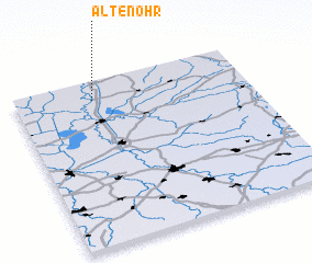 Places with similar names to Altenohr, Germany ::
Disclaimer :: Information on this page comes without warranty of any kind |
||
|
Where is Altenohr? Elevation and coordinates ::
Latitude (lat): 52°53'0"N Longitude (lon): 7°20'0"E
Elevation (approx.): 11m (map arrows pan, magnifying glasses zoom) |
||
|
Visiting Altenohr? Hotel/Accommodation ::
Book a hotel in Altenohr Travel Guide ::
Buy a travel guide for Germany rental cars ::
car rental offers GPS waypoint ::
download a GPX waypoint (PoI) of Altenohr for your GPS receiver
|
||