|
search place name
|
||
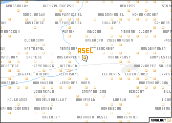
Asel (Niedersachsen, Germany)Asel is a town in the Niedersachsen region of Germany. An overview map of the region around Asel is displayed below.
regional and 3d topo map of Asel, Germany ::
Asel airports ::
The nearest airport is WVN - Wilhelmshaven Mariensiel, located 18.0 km south east of Asel.
Other airports nearby include NRD - Norderney (41.1 km west), EME - Emden (44.6 km south west), BRV - Bremerhaven (50.8 km east), BMK - Borkum (73.3 km west), Nearby towns ::
Toquard (1.9km north) //
Eggelingen (2.2km north east) //
Burmönken (3.7km south) //
Uttel (2.2km west) //
Mosewarfen (2.2km west) //
Groß Scheep (2.9km north east) //
Wittmund (2.9km south west) //
Greehörn (3.9km north) //
Nenndorf (2.9km north west) //
Klein Isums (4.3km south west) //
Möns (5.6km south) //
Berdumer Großeriege (5.6km north) //
Berdum (5.6km north) //
Sandel (5.7km south) //
Middoge (5.7km north) //
Updorf (3.8km south west) //
Wiefels (3.8km north east) //
Quanens (3.8km north east) //
Cleverns (5.0km south east) //
Barderstede (5.0km south east) //
Funnixer Großeriege (6.0km north) //
Funnix (6.0km north) //
Leerhafe (6.0km south) //
Bussenhausen (5.0km north east) //
Nordergast (4.4km east) //
Hattersum (4.4km west) //
Grappermöns (7.5km south) //
Rispel (7.5km south) //
Utlande (4.8km north east) //
[all distances 'as the bird flies' and approximate] 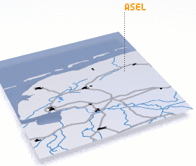 Places with similar names to Asel, Germany ::
Disclaimer :: Information on this page comes without warranty of any kind |
||
|
Where is Asel? Elevation and coordinates ::
Latitude (lat): 53°35'0"N Longitude (lon): 7°49'0"E
Elevation (approx.): -1m (map arrows pan, magnifying glasses zoom) |
||
|
Visiting Asel? Hotel/Accommodation ::
Book a hotel in Asel Travel Guide ::
Buy a travel guide for Germany rental cars ::
car rental offers GPS waypoint ::
download a GPX waypoint (PoI) of Asel for your GPS receiver
|
||