|
search place name
|
||
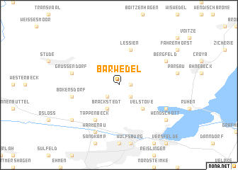
Barwedel (Niedersachsen, Germany)Barwedel is a town in the Niedersachsen region of Germany. An overview map of the region around Barwedel is displayed below.
regional and 3d topo map of Barwedel, Germany ::
Barwedel airports ::
The nearest airport is BWE - Braunschweig Wolfsburg, located 26.9 km south west of Barwedel.
Other airports nearby include ZCN - Celle (52.3 km west), HAJ - Hannover (74.9 km west), SZW - Schwerin Parchim (121.6 km north east), XFW - Hamburg Finkenwerder (130.0 km north west), Nearby towns ::
Tiddische (1.1km east) //
Jembke (2.2km south west) //
Hoitlingen (2.2km south east) //
Brackstedt (3.9km south) //
Velstove (4.3km south east) //
Lessien (5.7km north) //
Ehra (5.7km north) //
Tappenbeck (6.0km south) //
Grußendorf (4.9km west) //
Bokensdorf (4.9km west) //
Bergfeld (5.8km north east) //
Warmenau (7.7km south) //
Eischott (5.8km south east) //
Weyhausen (7.2km south west) //
Wendschott (7.2km south east) //
[all distances 'as the bird flies' and approximate] 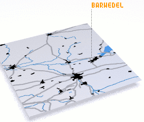 Places with similar names to Barwedel, Germany ::
// Barāwaḑalī (IQ)
// Barwadili (IN)
Disclaimer :: Information on this page comes without warranty of any kind |
||
|
Where is Barwedel? Elevation and coordinates ::
Latitude (lat): 52°31'0"N Longitude (lon): 10°47'0"E
Elevation (approx.): 68m (map arrows pan, magnifying glasses zoom) |
||
|
Visiting Barwedel? Hotel/Accommodation ::
Book a hotel in Barwedel Travel Guide ::
Buy a travel guide for Germany rental cars ::
car rental offers GPS waypoint ::
download a GPX waypoint (PoI) of Barwedel for your GPS receiver
|
||