|
search place name
|
||
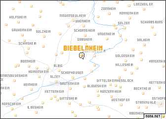
Biebelnheim (Rheinland-Pfalz, Germany)Biebelnheim is a town in the Rheinland-Pfalz region of Germany. An overview map of the region around Biebelnheim is displayed below.
regional and 3d topo map of Biebelnheim, Germany ::
Biebelnheim airports ::
The nearest airport is FRA - Frankfurt Main, located 37.0 km north east of Biebelnheim.
Other airports nearby include MHG - Mannheim City (43.8 km south east), RMS - Ramstein Ab (57.4 km south west), ZQC - Speyer (58.6 km south), HHN - Frankfurt Hahn (67.3 km west), Nearby towns ::
Bechtolsheim (1.9km north east) //
Gau-Odernheim (2.2km south east) //
Gau-Köngernheim (2.9km south east) //
Gabsheim (3.5km north) //
Framersheim (4.3km south) //
Schafhausen (4.4km south) //
Spiesheim (3.4km north west) //
Schornsheim (5.5km north) //
Albig (4.4km south west) //
Gau-Heppenheim (6.1km south) //
Ensheim (4.1km west) //
Undenheim (5.8km north east) //
Dautenheim (6.8km south) //
Udenheim (7.6km north) //
Wörrstadt (6.7km north west) //
Blödesheim (7.4km south) //
Alzey (6.4km south west) //
Ober-Saulheim (7.8km north) //
Bermersheim (5.5km west) //
Dittelsheim (6.9km south east) //
Hochborn (8.4km south) //
Nieder-Saulheim (8.9km north) //
Frettenheim (6.7km south east) //
Dittelsheim-Heßloch (7.6km south east) //
Köngernheim (7.7km north east) //
Sulzheim (7.7km north west) //
Hahnheim (8.6km north east) //
Wahlheimer Hof (9.0km north east) //
Heßloch (8.2km south east) //
[all distances 'as the bird flies' and approximate]  Places with similar names to Biebelnheim, Germany ::
// Beblenheim (FR)
Disclaimer :: Information on this page comes without warranty of any kind |
||
|
Where is Biebelnheim? Elevation and coordinates ::
Latitude (lat): 49°47'48"N Longitude (lon): 8°10'14"E
Elevation (approx.): 153m (map arrows pan, magnifying glasses zoom) |
||
|
Visiting Biebelnheim? Hotel/Accommodation ::
Book a hotel in Biebelnheim Travel Guide ::
Buy a travel guide for Germany rental cars ::
car rental offers GPS waypoint ::
download a GPX waypoint (PoI) of Biebelnheim for your GPS receiver
|
||