|
search place name
|
||
Blumenhagen (Mecklenburg-Vorpommern, Germany)Blumenhagen is a town in the Mecklenburg-Vorpommern region of Germany. An overview map of the region around Blumenhagen is displayed below.
regional and 3d topo map of Blumenhagen, Germany ::

Blumenhagen airports ::
The nearest airport is RLG - Laage, located 80.0 km north west of Blumenhagen.
Other airports nearby include SZW - Schwerin Parchim (88.7 km west), TXL - Berlin Tegel (94.2 km south), THF - Berlin Tempelhof (105.0 km south), SXF - Berlin Schonefeld (116.7 km south), Nearby towns ::
Weisdin (1.1km west) //
Blumenholz (1.9km north) //
Wendfeld (3.7km north) //
Ehrenhof (4.3km north east) //
Neustrelitz (4.3km south west) //
Prillwitz (5.7km north) //
Hohenzieritz (5.7km north) //
Zinow (5.0km south east) //
Zippelow (7.4km north) //
Thürow (4.8km south east) //
Strelitz Alt (7.5km south) //
Buchenwalde (6.5km south west) //
Zierke (5.8km south west) //
Brustorf (5.8km north west) //
Jennyhof (7.7km north) //
Usadel (7.1km north east) //
Zachow (7.1km north west) //
Peckatel (7.1km north west) //
[all distances 'as the bird flies' and approximate] 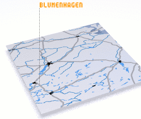 Places with similar names to Blumenhagen, Germany ::
Disclaimer :: Information on this page comes without warranty of any kind |
||
|
Where is Blumenhagen? Elevation and coordinates ::
Latitude (lat): 53°24'0"N Longitude (lon): 13°7'0"E
Elevation (approx.): 71m (map arrows pan, magnifying glasses zoom) |
||
|
Visiting Blumenhagen? Hotel/Accommodation ::
Book a hotel in Blumenhagen Travel Guide ::
Buy a travel guide for Germany rental cars ::
car rental offers GPS waypoint ::
download a GPX waypoint (PoI) of Blumenhagen for your GPS receiver
|
||