|
search place name
|
||
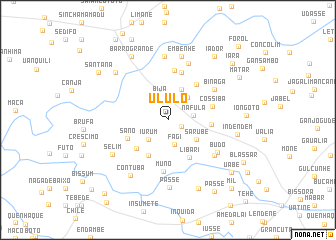
Ululo (Oio, Guinea-Bissau)Ululo is a town in the Oio region of Guinea-Bissau. An overview map of the region around Ululo is displayed below.
regional and 3d topo map of Ululo, Guinea-Bissau ::
Ululo airports ::
The nearest airport is BXO - Bissau Oswaldo Vieira Intl, located 45.8 km south of Ululo.
Other airports nearby include ZIG - Ziguinchor (81.3 km west), CSK - Cap Skiring (127.4 km west), BJL - Banjul Intl (163.3 km north west), KLC - Kaolack (210.3 km north), Nearby towns ::
Quijim (1.6km south east) //
Fagi (2.8km south) //
Bija (2.8km north) //
Nafula (2.8km east) //
Iurum (3.0km south west) //
Faja (3.0km south west) //
Damberá (3.4km north east) //
Encheia (3.7km north east) //
Sarubè (3.7km south east) //
Udamo (4.5km south west) //
Bucancadi (4.7km south west) //
Libari (4.7km south east) //
Cossicunto (4.7km east) //
Sano (4.9km south west) //
Ianganã (5.0km north east) //
Cossiba (5.0km east) //
Caame (5.5km north) //
Nagate (5.6km north) //
Muno (5.8km south) //
Binaga (6.1km north east) //
Uaqueri (6.5km south east) //
Budo (6.5km south east) //
Queré (6.7km north) //
Biur (7.1km north) //
Embenhe (7.3km north) //
Selim (7.2km south west) //
Contuba (7.4km south west) //
Passe (7.6km south) //
Ponta Nova (7.8km north west) //
[all distances 'as the bird flies' and approximate] 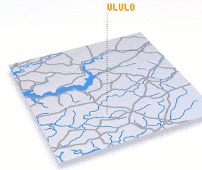 Places with similar names to Ululo, Guinea-Bissau ::
Disclaimer :: Information on this page comes without warranty of any kind |
||
|
Where is Ululo? Elevation and coordinates ::
Latitude (lat): 12°18'9"N Longitude (lon): 15°34'49"W
Elevation (approx.): 28m (map arrows pan, magnifying glasses zoom) |
||
|
Visiting Ululo? Hotel/Accommodation ::
Book a hotel in Ululo Travel Guide ::
rental cars ::
car rental offers GPS waypoint ::
download a GPX waypoint (PoI) of Ululo for your GPS receiver
|
||