|
search place name
|
||
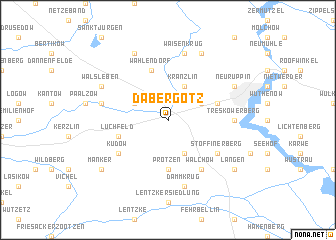
Dabergotz (Brandenburg, Germany)Dabergotz is a town in the Brandenburg region of Germany. An overview map of the region around Dabergotz is displayed below.
regional and 3d topo map of Dabergotz, Germany ::
Dabergotz airports ::
The nearest airport is TXL - Berlin Tegel, located 53.3 km south east of Dabergotz.
Other airports nearby include THF - Berlin Tempelhof (65.7 km south east), SXF - Berlin Schonefeld (78.8 km south east), SZW - Schwerin Parchim (86.5 km north west), RLG - Laage (117.3 km north), Nearby towns ::
Stöffin (3.9km south) //
Werder (2.9km north west) //
Kränzlin (3.9km north) //
Bechlin (2.9km north east) //
Protzen (5.6km south) //
Darritz (5.7km north) //
Wahlendorf (5.7km north) //
Kränzliner Siedlung (3.8km north east) //
Lüchfeld (3.8km south west) //
Stöffiner Berg (5.0km south east) //
Küdow (5.0km south west) //
Walchow (6.0km south) //
Treskow (4.5km east) //
Treskowerberg (4.5km east) //
Gottberg (4.8km north west) //
Storbecker Siedlung (7.5km north) //
Dammkrug (7.5km south) //
Waisenkrug (7.5km north) //
Walsleben (5.8km north west) //
Groß Woltersdorf (7.7km north) //
Neuruppin (5.8km north east) //
Storbeck (7.7km north) //
Manker (7.1km south west) //
Langen (7.1km south east) //
[all distances 'as the bird flies' and approximate] 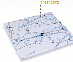 Places with similar names to Dabergotz, Germany ::
Disclaimer :: Information on this page comes without warranty of any kind |
||
|
Where is Dabergotz? Elevation and coordinates ::
Latitude (lat): 52°54'0"N Longitude (lon): 12°44'0"E
Elevation (approx.): 39m (map arrows pan, magnifying glasses zoom) |
||
|
Visiting Dabergotz? Hotel/Accommodation ::
Book a hotel in Dabergotz Travel Guide ::
Buy a travel guide for Germany rental cars ::
car rental offers GPS waypoint ::
download a GPX waypoint (PoI) of Dabergotz for your GPS receiver
|
||